Maps of Grand Ledge |
Browse the maps by type, look carefully at the air photos and read the location info. |
Other Maps
Note: Some maps require Adobe Acrobat to read pdf files.
2003 Bedrock Geologic Map (pdf)
1987 Bedrock Geologic Map (pdf)
Stratigraphic Nomenclature of MI (pdf)
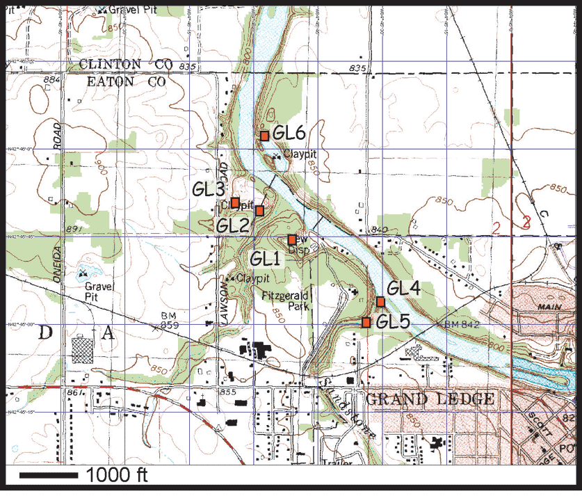
Local Topographic Map. Click to enlarge.Directions from Grand Rapids: Take Lake Michigan Drive (M45) south for 11 miles. Merge onto I-196 east toward Lansing for 6 miles. I-196 becomes I-96, take this for about 50 miles. Take the M-100 exit or exit 86 toward Grand Ledge. Take a right onto S Wright Rd (Mi-100). Follow for 3 miles. Turn slight right onto N Bridge St. (MI-100). Turn right onto W Jefferson St. Follow this until Fitzgerald Park Drive, and turn right into the park.
From Fitzgerald Park, take a left onto Jefferson St. Left onto N Bridge St. crossing the river. The second street on the left is Main St. Turn left until it turns into Tallman Rd. Drive until you see park entrance on the left (Lincoln Brick Park).
Approx elevation: In the range of 800-820 feet.
| Tours | Photos | Videos | References | Maps | GL Home | Home |