Maps of the Marquette Area |
Browse the maps by type, look carefully at the air photos and read the location info. |
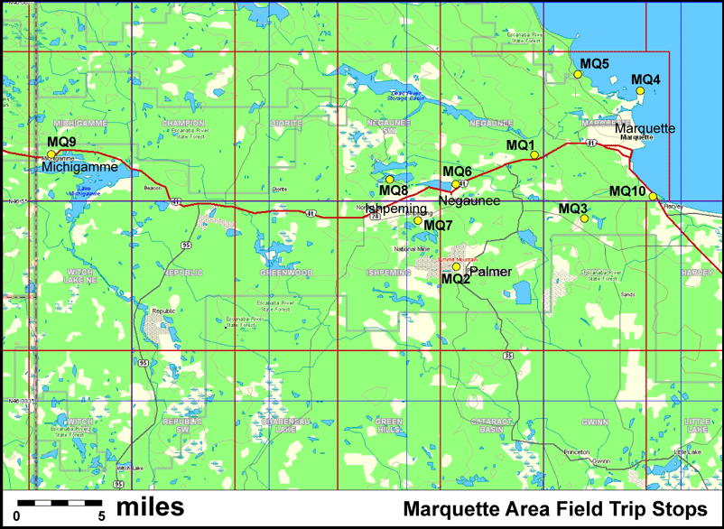
Location Key: |
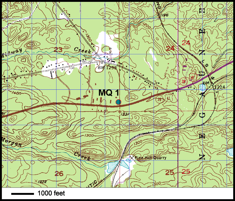
MQ1 -- Pillow Basalts
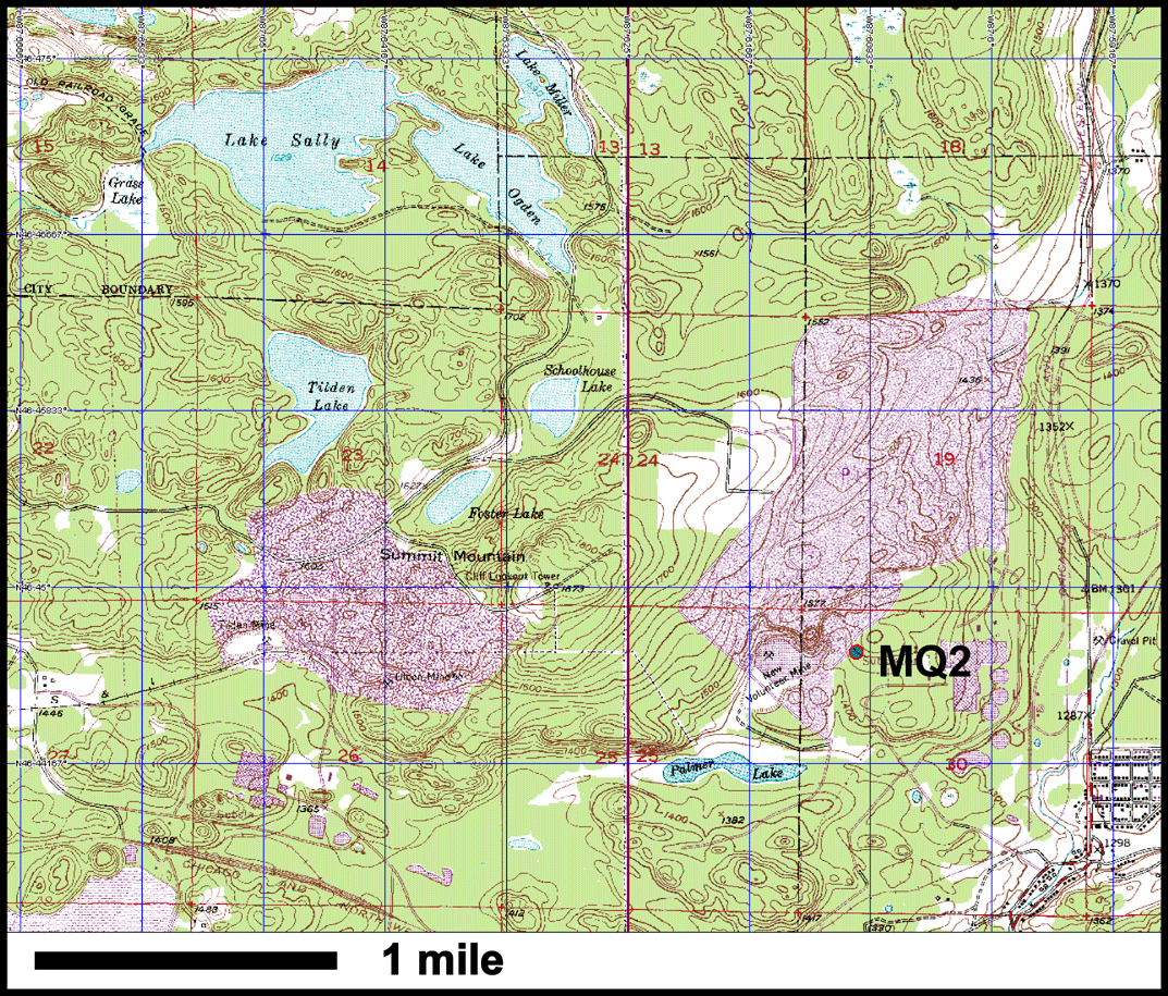
MQ2 -- Empire/Tilden Mine
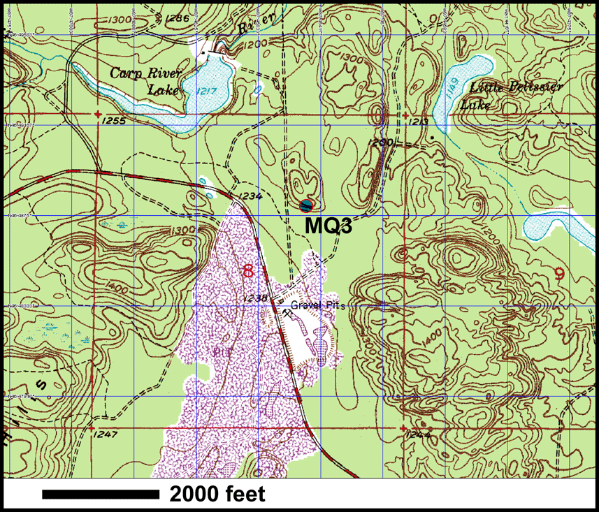
MQ3 -- Kona Dolomite Quarry
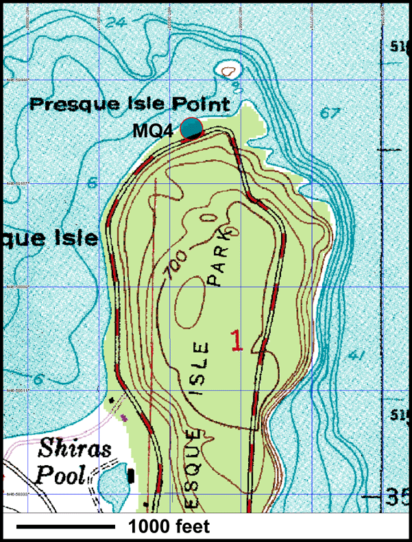
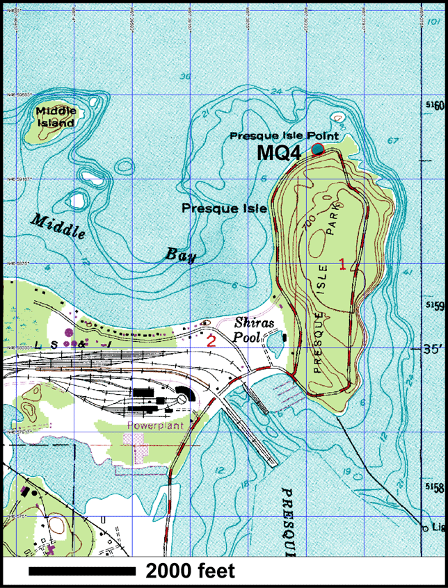
MQ4 -- Presque Isle
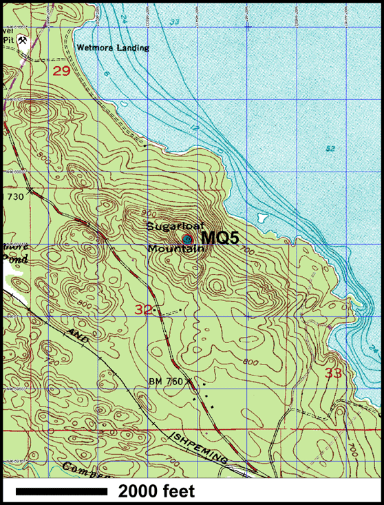
MQ5 -- Sugarloaf Mtn.
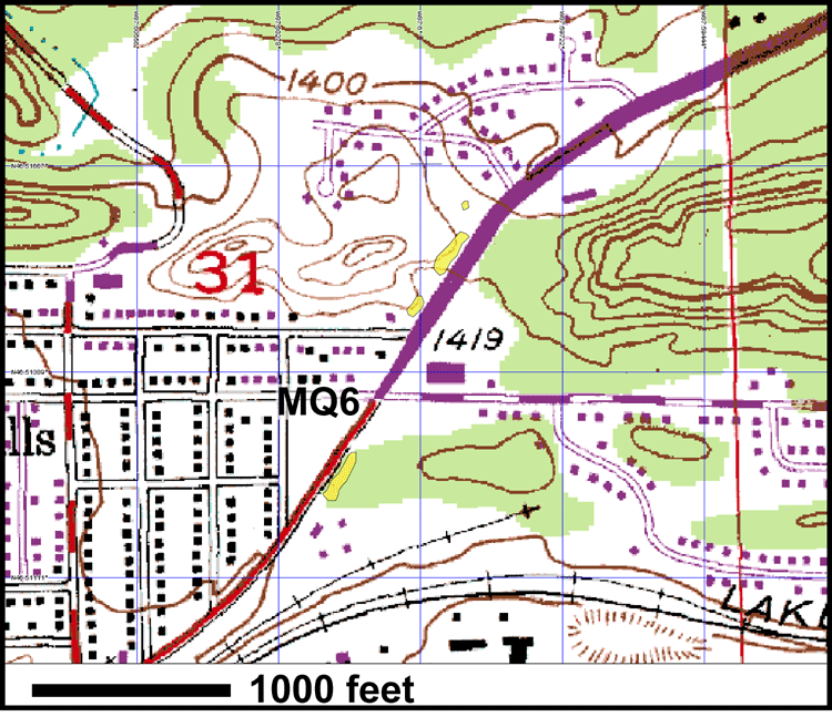
MQ6 -- Negaunee
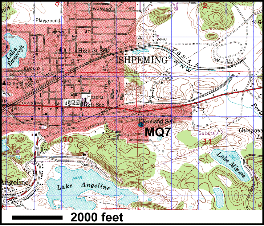
MQ7 -- Jasper Knob
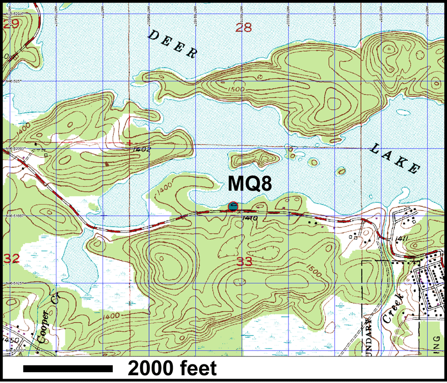
MQ8 -- Deer Lake
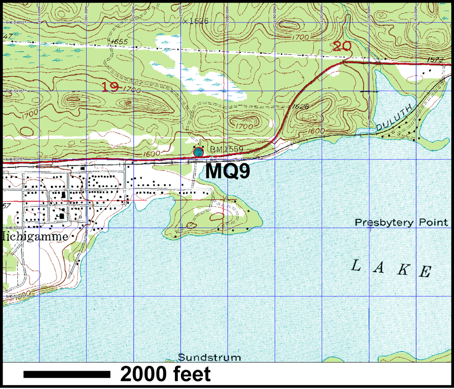
MQ9 -- Michigamme
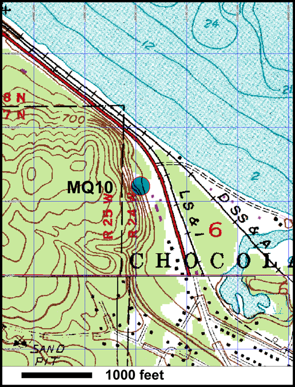
MQ10 -- Harvey Quarry |
Location Info:
City: Marquette
County: Marquette
GPS:
Directions from Grand Rapids:
Noted features:
Approx elevation: 2500 feet
| Tours | Photos | Videos | References | Maps | MA Home | Home |
Map Index
Click to enlarge any map. Maximize for best view.
Pillow Basalts in Archean Mona Schist |
|
|---|---|
| Empire/Tilden Mine | |
| Kona Dolomite Quarry (Lindberg Quarry). Middle Proterozoic. | |
| Presque Isle Peridotite and Jacobsville Sandstone (close up) | |
| Presque Isle Peridotite and Jacobsville Sandstone. | |
| Sugarloaf Mountain. Archean Granite. | |
| Several Rocks at Negaunee. Mona Schist unconformity overlain by Proterozoic sequence. | |
| Jasper Knob. In the city of Ishpeming. Consists of precambrian jaspilite which is thin alternating layers of specular hematite and red chert. | |
| Archean Fragmental Dacite. | |
| Michigamme. Proterozoic. | |
| Harvey Quarry | |
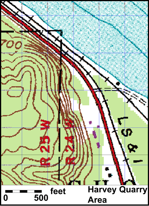
| Close up of Harvey Quarry. | |
| Marquette Area overview map. |