Marquette Area Photos
Click on photos for larger images. Maximize window for best detail.
Location Key: |
MQ1 -- Pillow Basalts MQ2 -- Empire/Tilden Mine MQ3 -- Kona Dolomite Quarry MQ4 -- Presque Isle MQ5 -- Sugarloaf Mtn. MQ6 -- Negaunee MQ7 -- Jasper Knob MQ8 -- Deer Lake MQ9 -- Michigamme MQ10 -- Harvey Quarry |
| Tours | Photos | Videos | References | Maps | MA Home | Home |
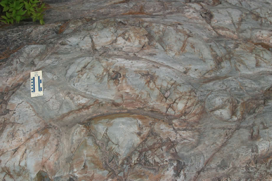 |
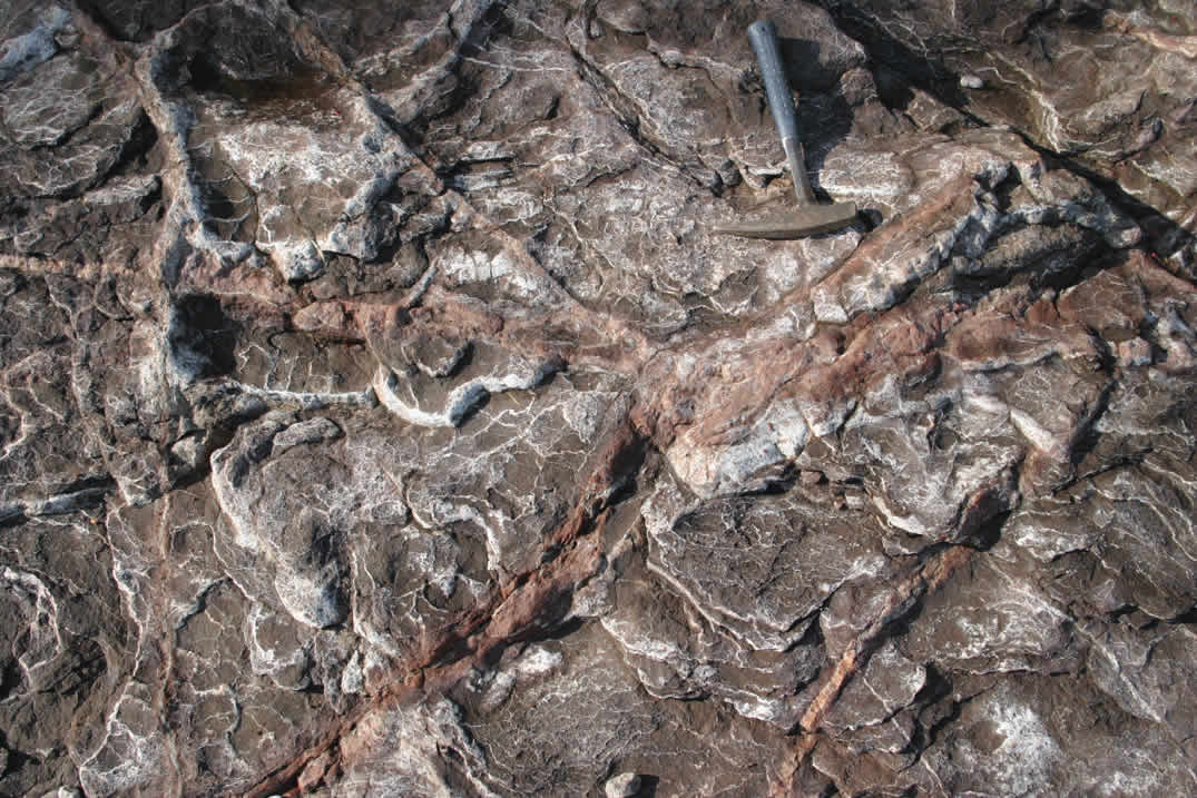
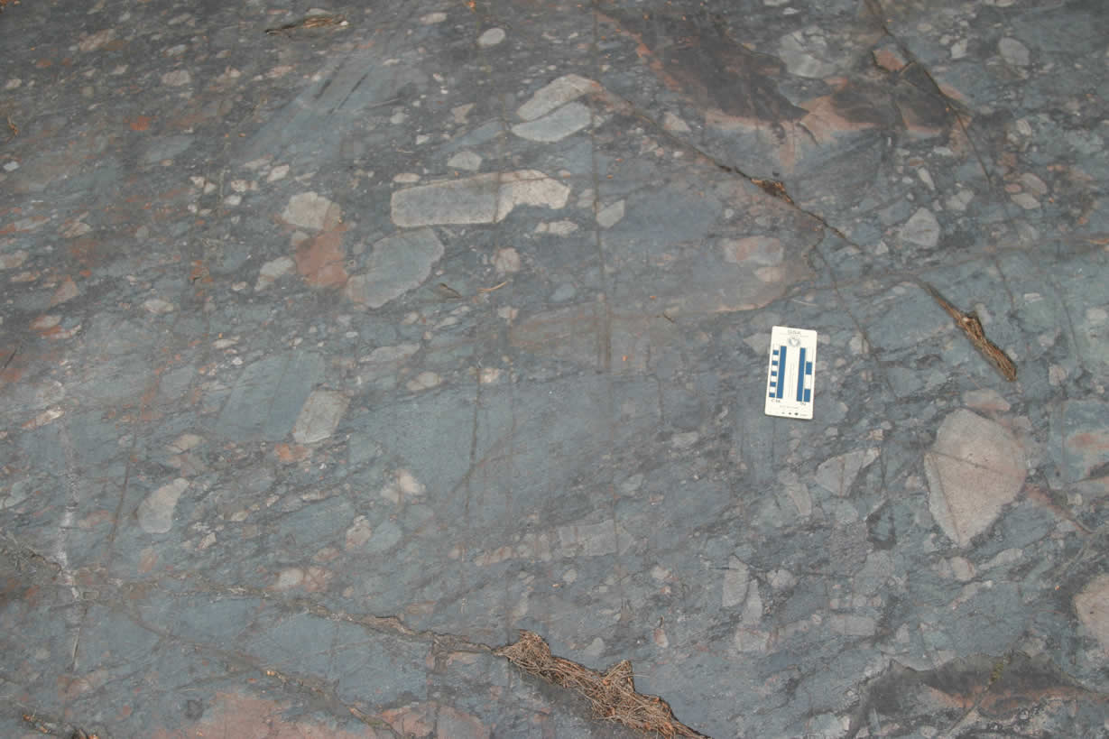
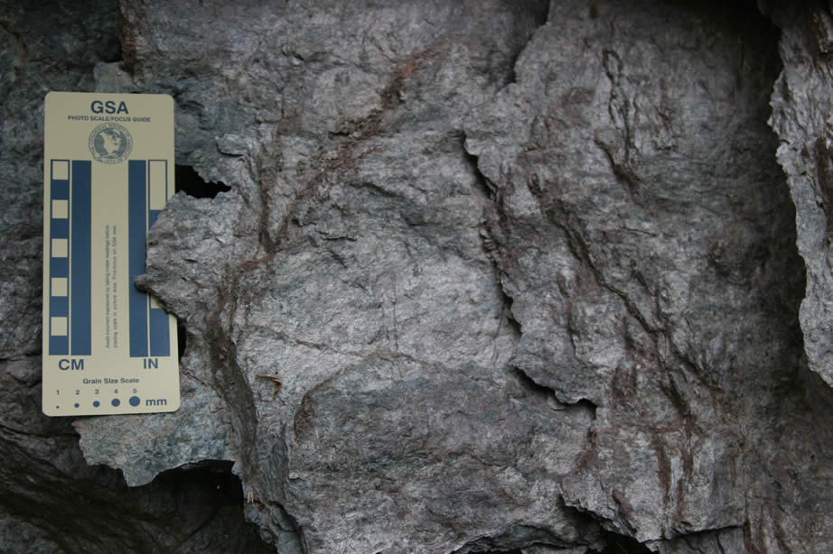
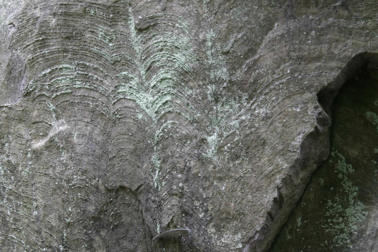
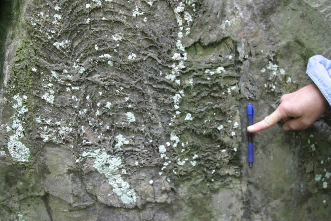
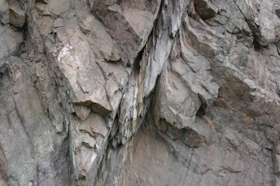
Pillows in basalt -- Archean Mona Schist. |
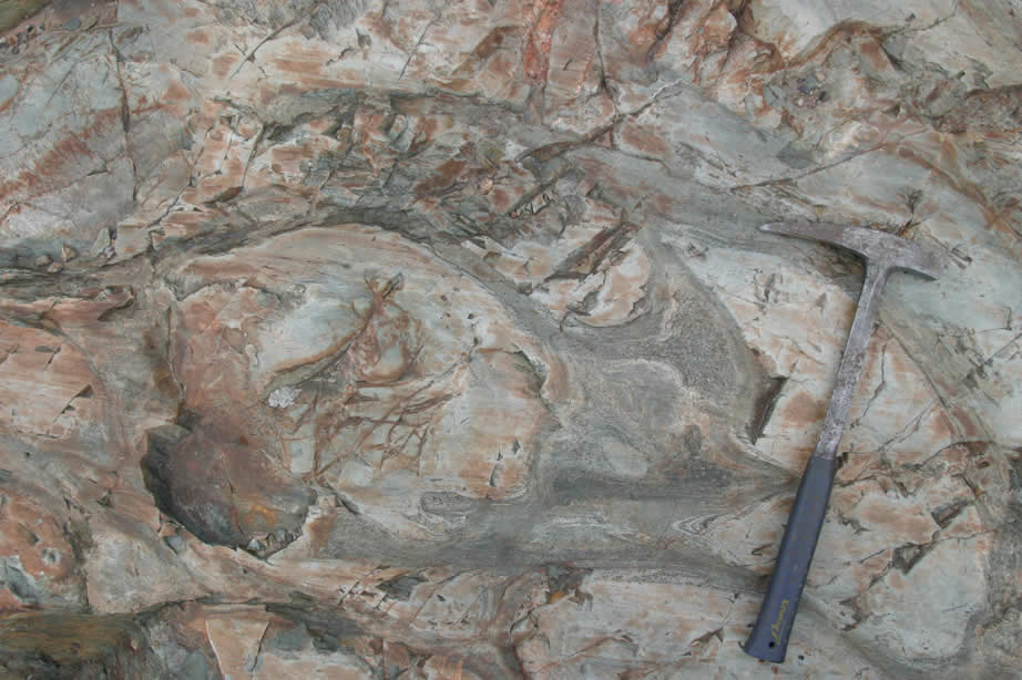 |
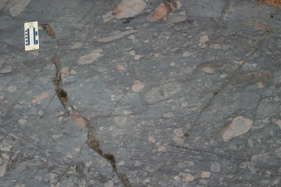
Pillows in basalt -- Archean Mona Schist. |
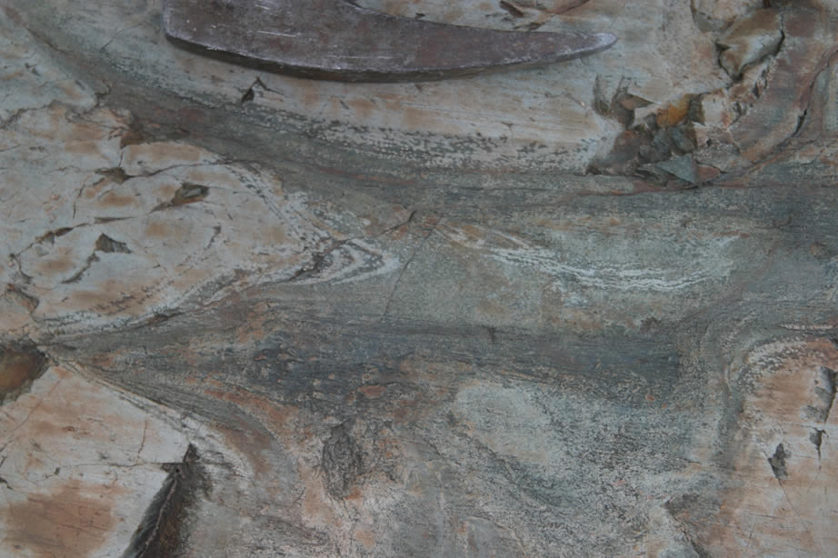 |
Pillows in basalt - Archean Mona Schist. Note the light colored spots - possibly immiscible droplets near pillow margin |
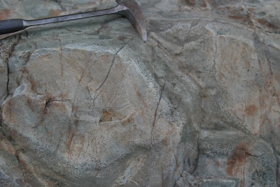 |
Pillows in basalt - Archean Mona Schist. |
 |
Pillows in basalt - Archean Mona Schist. |
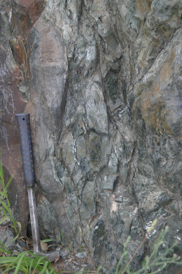 |
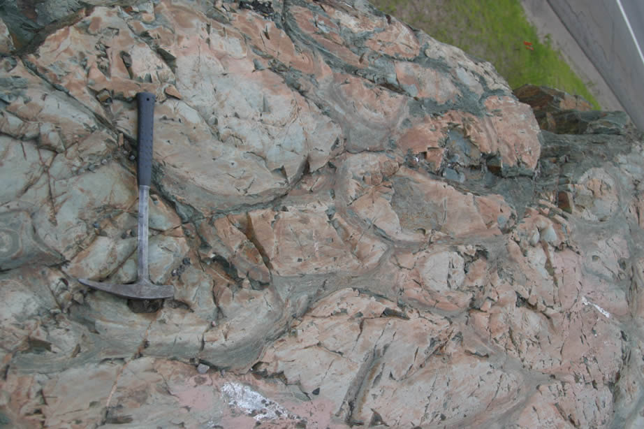
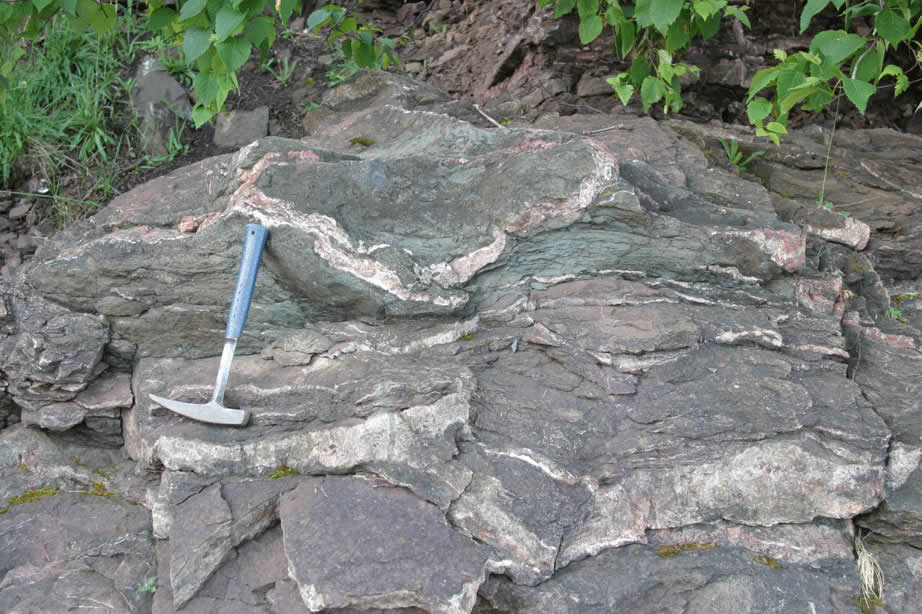
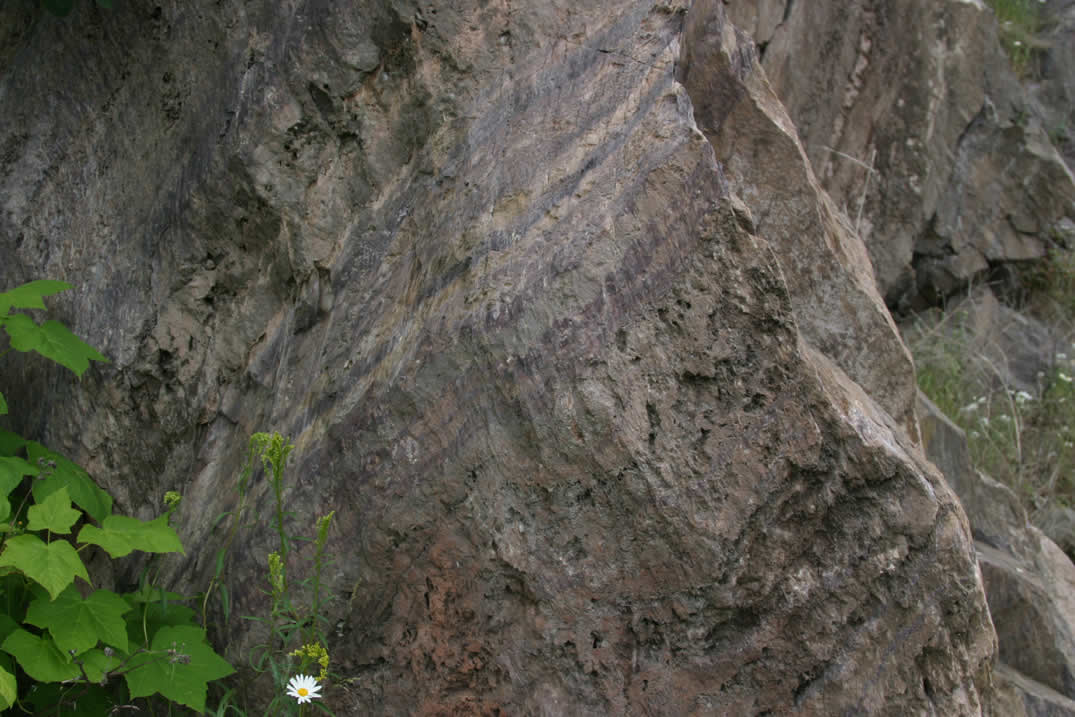
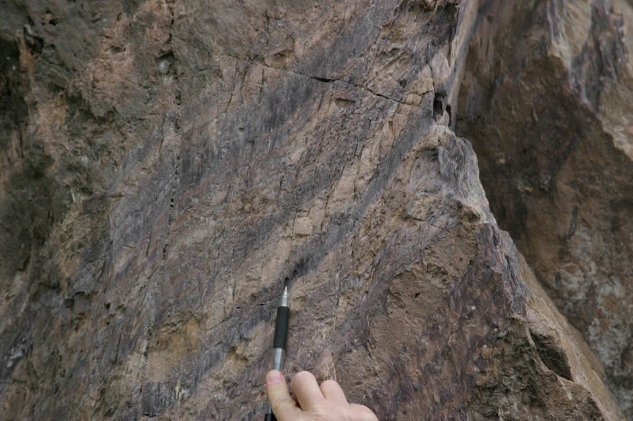
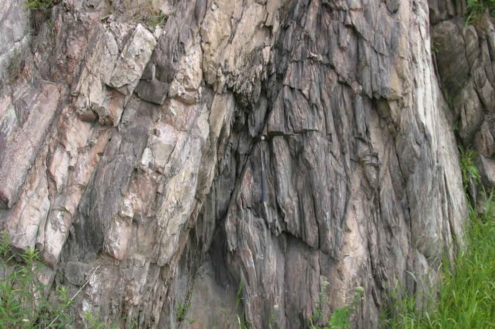
Steeply dipping shear zone in pillow basalt - Archean Mona Schist with dark serpentine as sheared matrix to less deformed basalt w/in zone - looking North |
 |
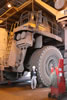
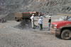
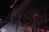
Jon Burr climbing down from cab area of large ore truck, Tilden/Empire mine. |
 |
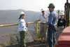
Jill Kurek standing next to a tire of large ore truck. |
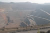 |
Empire mine pit overlook (stop A). |
 |
Empire mine pit overlook (stop A). |
 |
Empire mine pit overlook (stop A) - Ginny Peterson, Larry Fegel, Luis Sierra, Jill Kurek |
 |
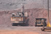
Empire Mine pit - at stop B - 625' elev. bench - shovel loading blasted ore onto truck. |
 |
Empire Mine pit - at stop B - 625' elev. bench - shovel mining blasted ore to load in ore truck. |
 |
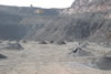
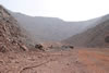
Talus fan in Empire pit, Empire/Tilden Mine, Negaunee. |
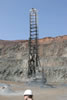 |
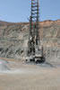
Drilling holes for explosives - CD V pit, Empire/Tilden mine - Stop C. |
 |
Pile surrounding hole drilled for explosives - CD V pit, Empire/Tilden mine - Larry, Luis, Ginny, Jill - Stop C. |
 |
Pile surrounding hole drilled for explosives - CD V pit, Empire/Tilden mine - Stop C. | - Stop
 |
Pile surrounding hole drilled for explosives - CD V pit, Empire/Tilden mine - Stop C. | -
 |
View of Tilden mine pit from east side - old overlook - Stop D. |
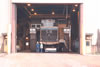 |
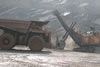
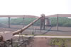
Large ore truck - Empire/Tilden mine. |
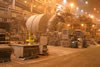 |
Grinding chambers - Tilden mine processing plant. |
 |
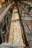
Belt transporting crushed ore that is too large to chamber for reprocessing, Tilden mine plant. |
 |
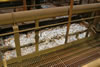
Screens with micron-scale crushed ore - steam thickening, Tilden mine processing plant. |
 |
Deslime thickening - cornstarch added to help separate ore - ore sinks and waste material floated off top, Tilden processing plant. |
 |
Deslime thickening - cornstarch added to help separate ore - ore sinks and waste material floated off top, Tilden processing plant. |
 |
Conveyer for processed ore, Tilden plant. |
 |
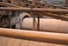
Large rotating cylinder and conveyer to round out the taconite pellets. |
 |
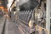
End view of part of kiln used in final processing of taconite pellets - brings pellets to 2200 degrees F, Tilden mine processing plant. |
 |
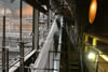
View from processing plant in vicinity of Kiln overlooking ductwork used to transport taconite pellets for storage and shipping, Tilden Mine. |
 |
Tailing settling tank, Tilden mine. |
 |
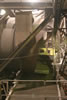
Tilden mine processing plant control room for part of the process. |
 |
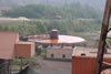
Tilden mine overlooking west. |
 |
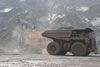
Shovel loading truck with ore at the bottom of the Tilden mine pit. |
 |
View looking east at bottom of the Tilden mine pit. |
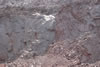 |
Ore rocks at bottom of Tilden mine pit. |
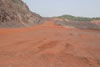 |
Orange cones mark spots for future drilling and blasting program in DC III pit - Empire/Tilden mine, stop G. |
 |
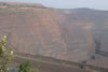
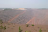
CD III pit from Stop G, Empire/Tilden mine. |
 |
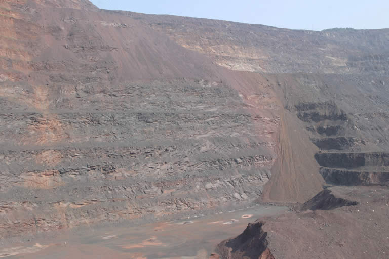
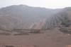
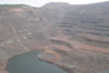
View to northeast from stop H - top of waste pile at Empire/Tilden mine - second highest point in Michigan @ 1900' elev. |
 |
View to northwest from stop H - top of waste pile at Empire/Tilden mine - second highest point in Michigan @ 1900' elev. |
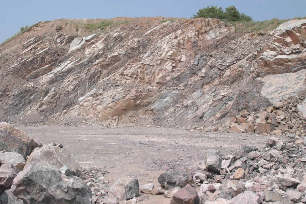 |
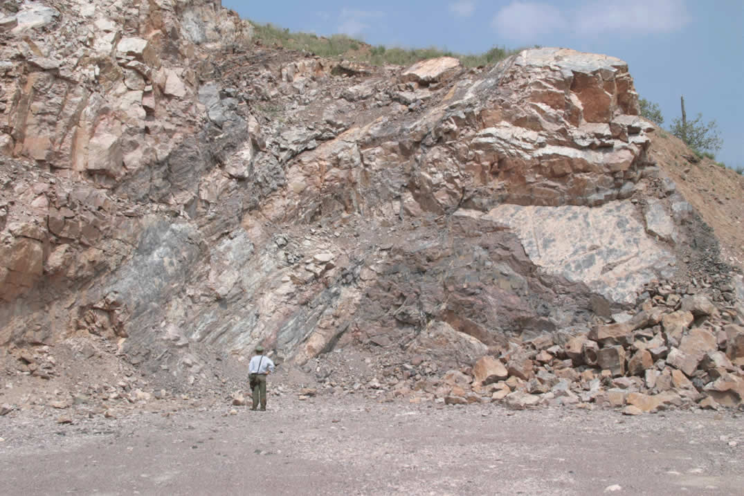
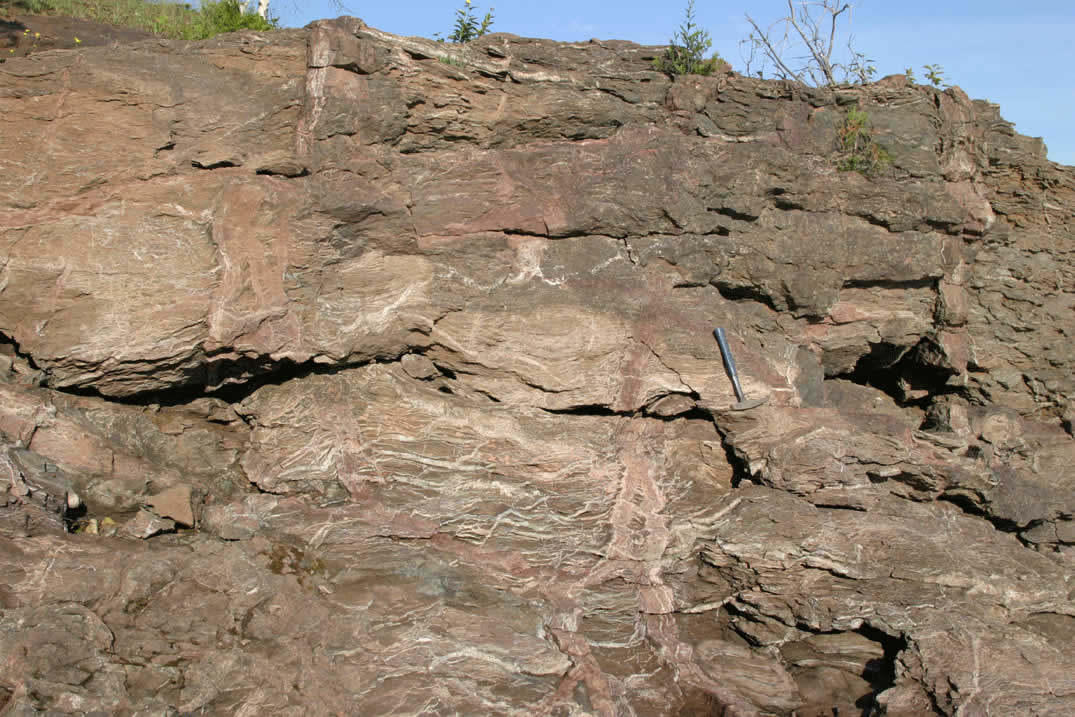
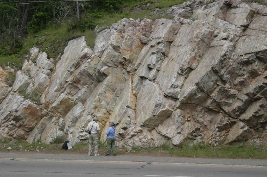
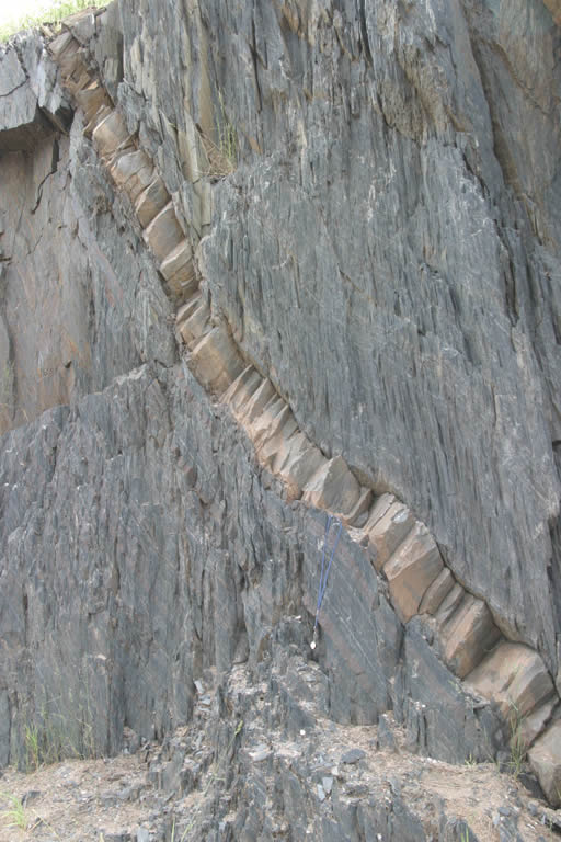
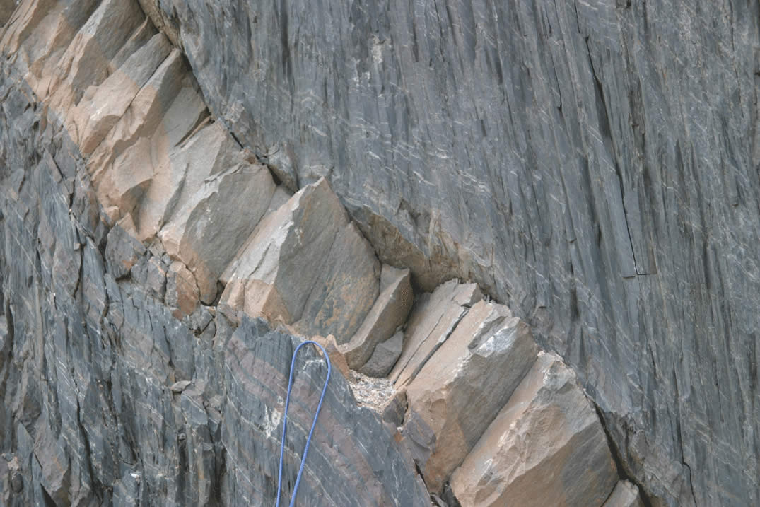
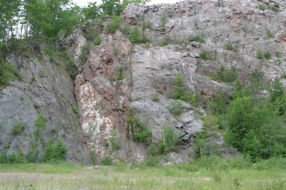
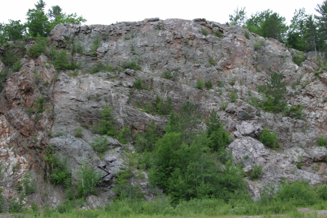
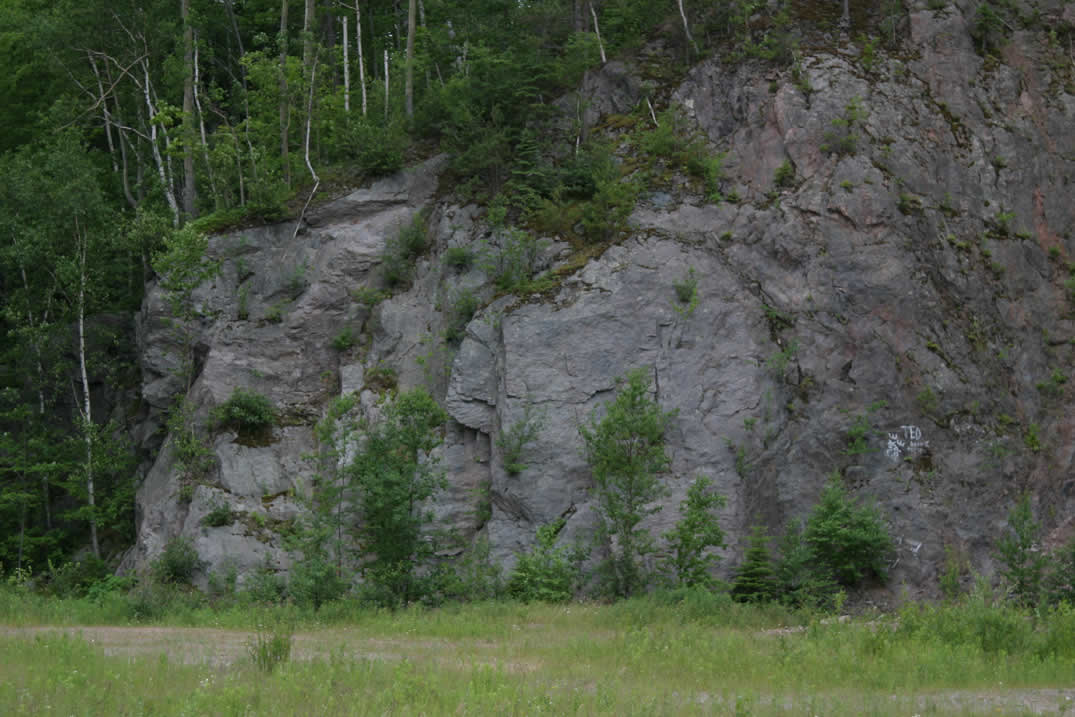
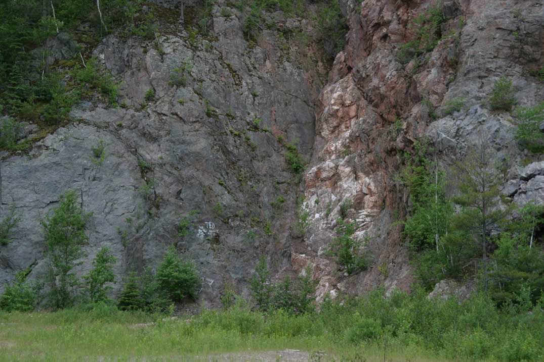
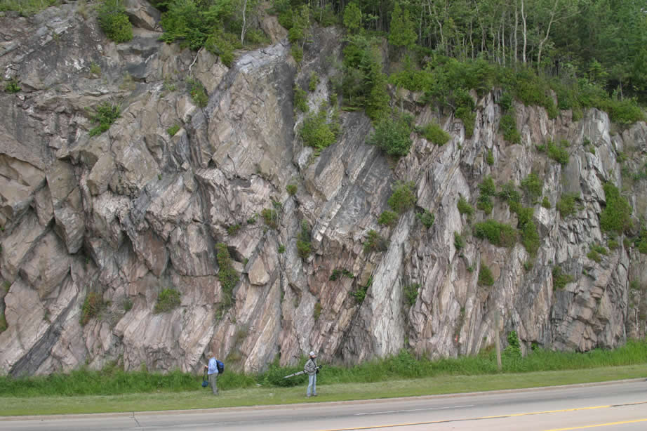
Lindberg Quarry in Kona Dolomite - quarry wall showing dipping layering |
 |
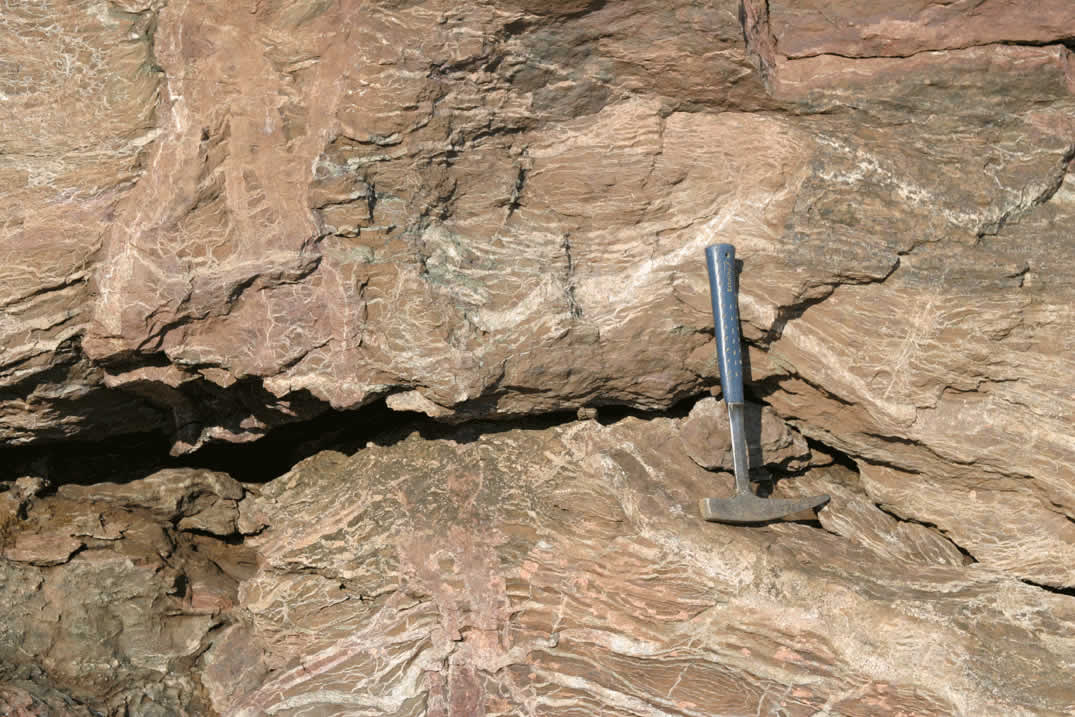
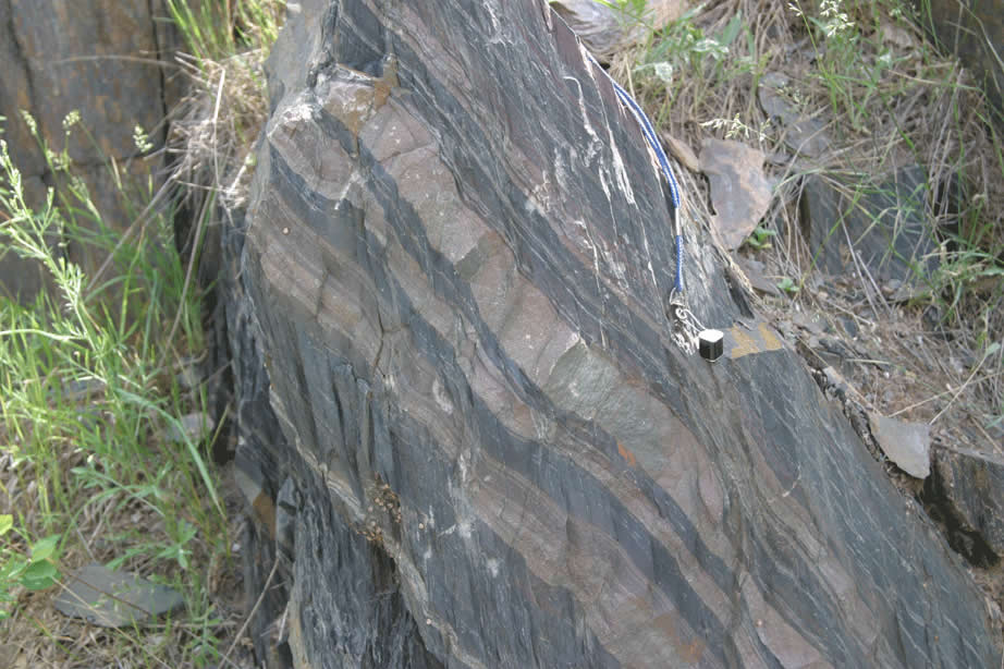
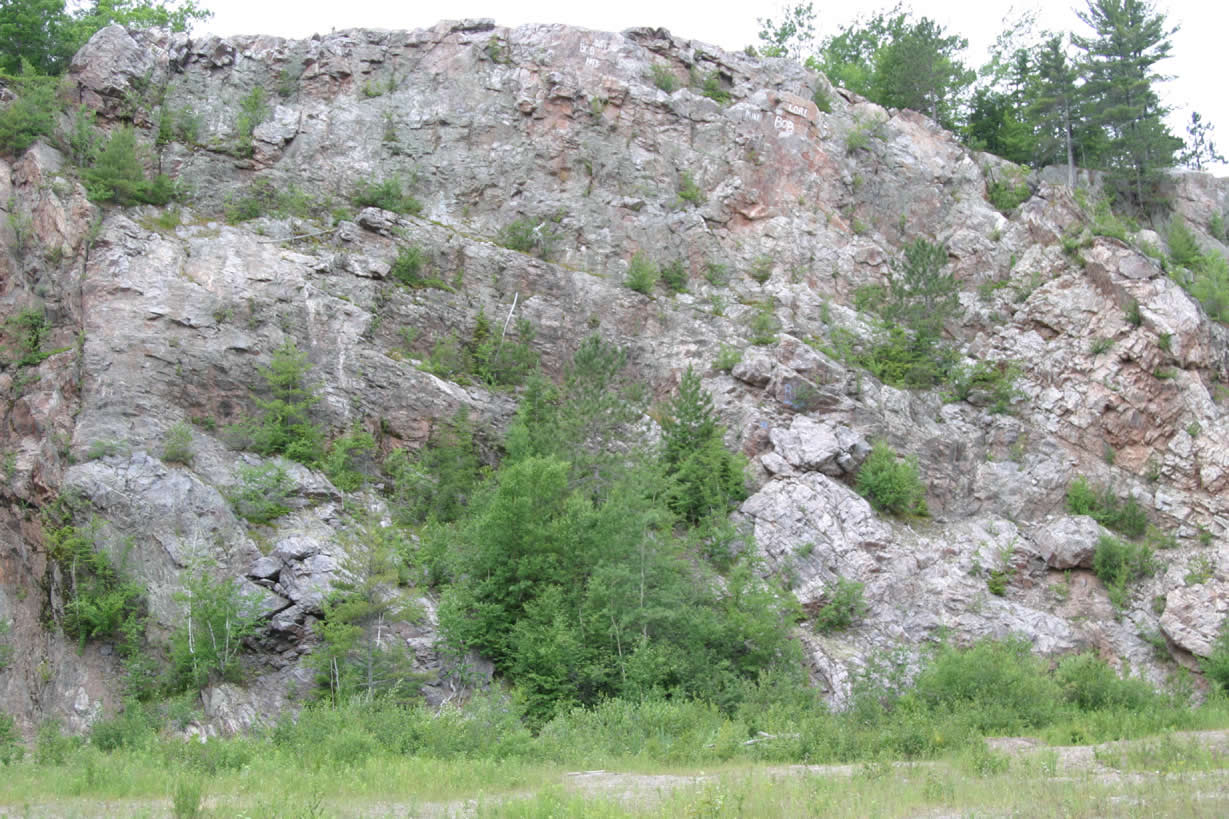
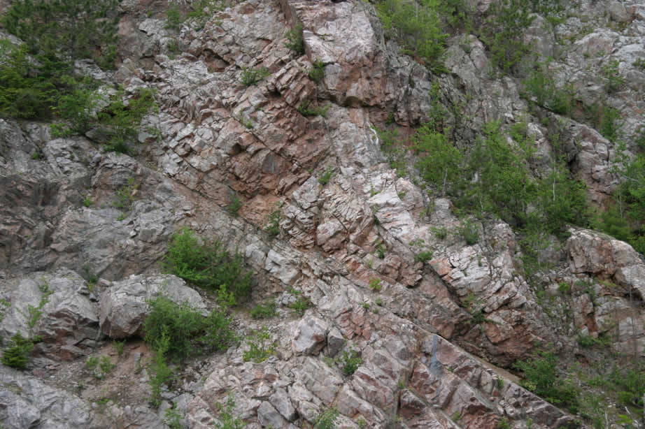
Lindberg Quarry in Kona Dolomite - quarry wall showing dipping layering. Jon Burr for scale. |
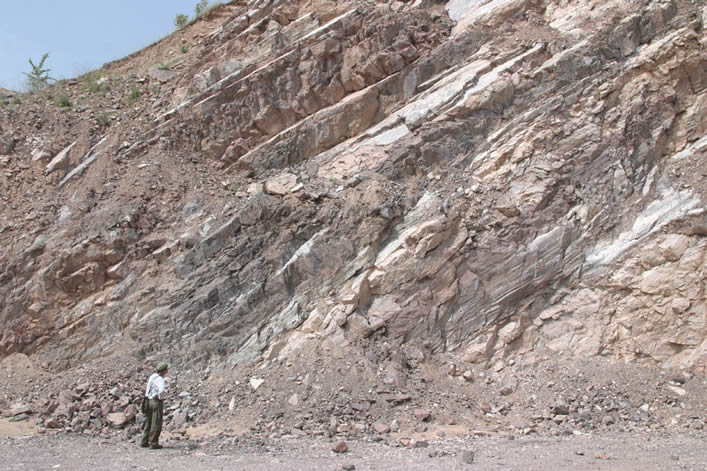 |
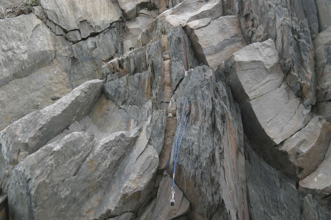
Lindberg Quarry in Kona Dolomite - quarry wall showing dipping layering. Jon Burr for scale. |
 |
|
 |
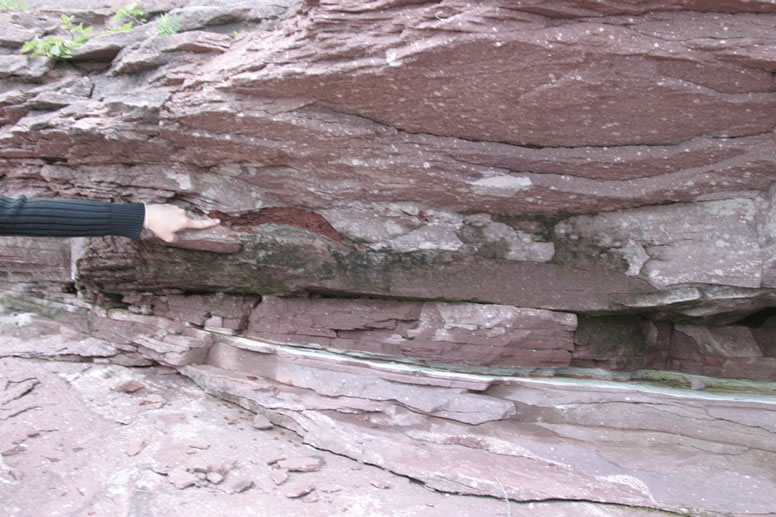
Jacobsville sandstone along eastern shore of Presque Isle, Marquette, near pier. White reduced area on either side of fracture. Larry Fegel for scale. Looking east along fracture. |
 |
Jacobsville sandstone along eastern shore of Presque Isle, Marquette, near pier. White reduced area on either side of fracture. Jill Kurek for scale. Looking west along fracture |
 |
Jacobsville sandstone along eastern shore of Presque Isle, Marquette, near pier. White reduced area on either side of fracture. Looking east along fracture. |
 |
Cross bedding in Jacobsville sandstone along eastern shore of Presque Isle, Marquette, near pier. Looking west. |
 |
Cross bedding in Jacobsville sandstone along eastern shore of Presque Isle, Marquette, near pier. Looking west. |
 |
Finger points to red shale clast in Jacobsville sandstone, note reduced white layer across lower part of slide - along eastern shore of Presque Isle, Marquette, near pier. Looking west. |
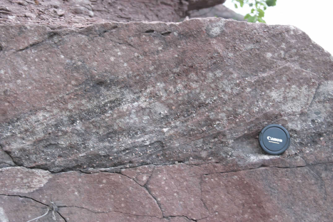 |
Cross bedding in Jacobsville sandstone along eastern shore of Presque Isle, Marquette, near pier. Looking west. |
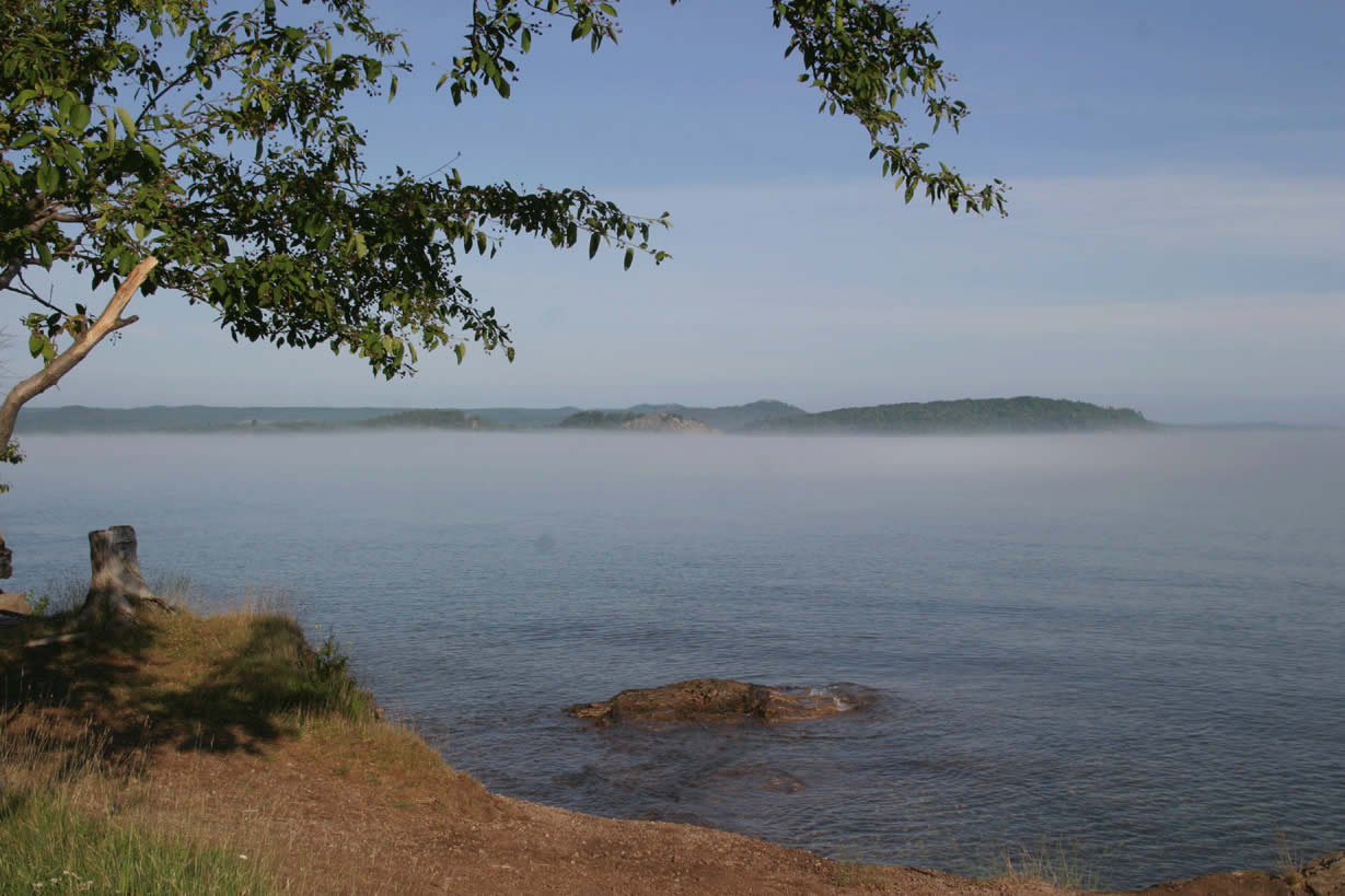 |
North shore of Presque Isle. Morning view toward north with mist on Lake Superior after evening storm. |
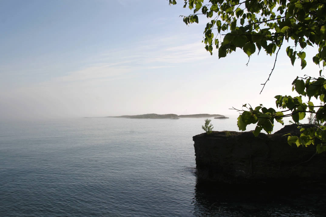 |
North shore of Presque Isle. Morning view toward northeast with mist on Lake Superior after evening storm. |
 |
North shore of Presque Isle. Peridotite with red dolomitic veins and spidery pale green serpentine veins. Looking NW. Hammer for scale. |
 |
North shore of Presque Isle. Peridotite with red dolomitic veins and spidery pale green serpentine veins. Looking NW. Hammer for scale. |
 |
North shore of Presque Isle. Conglomerate at base of Jacobsville SS with clasts of local rock including gneiss, chert, peridotite (not seen) Hammer for scale. |
 |
North shore of Presque Isle. Peridotite with red dolomitic veins and spidery pale green serpentine veins - overlain by brown poorly layered fine sand/siltstone interpreted as paleosol, topped by congomerate interpreted as base of Jacobsville SS. |
 |
North shore of Presque Isle. Peridotite with red dolomitic veins and spidery pale green serpentine veins and white quartz veins at center of some dolomitic veins - looking down. |
 |
North shore of Presque Isle. Peridotite with red dolomitic veins and spidery pale green serpentine veins and white quartz veins at center of some dolomitic veins - looking down. |
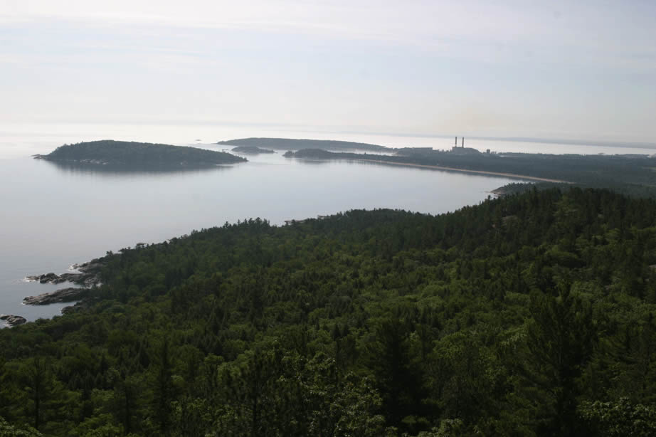 |
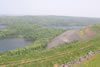
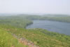
View south toward Marquette and Presque Isle from Sugarloaf Mountain. |
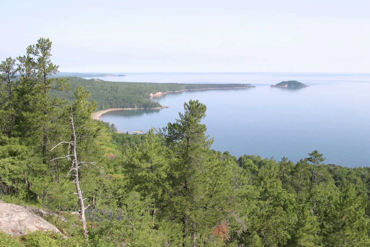 |
View north along coast from Sugarloaf Mountain. |
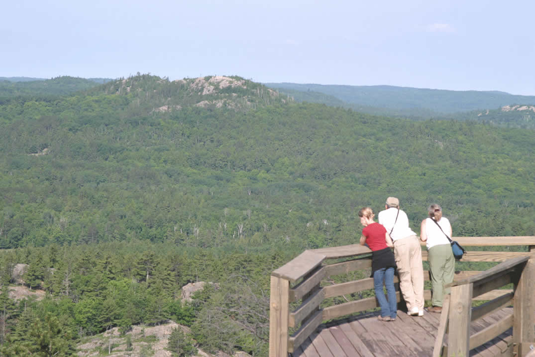 |
View west from Sugarloaf Mountain, Granite knob (Hogback mountain?) in center view (Jill, Larry, ginny). |
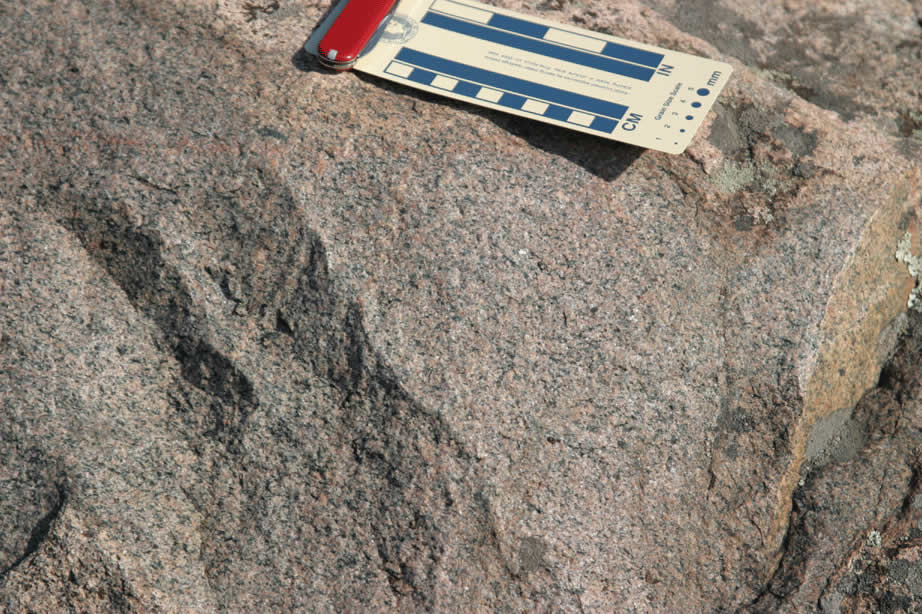 |
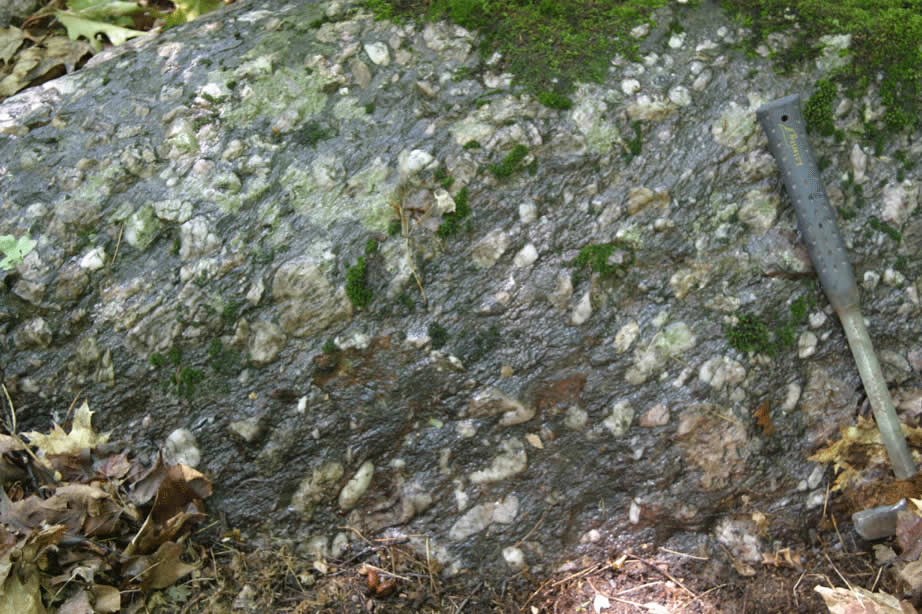
Sugarloaf Mtn. Granite close-up. |
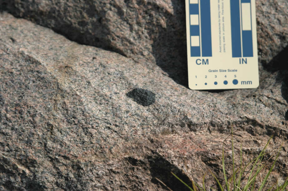 |
Sugarloaf Mountain. Close up of granite with small mafic inclusion. |
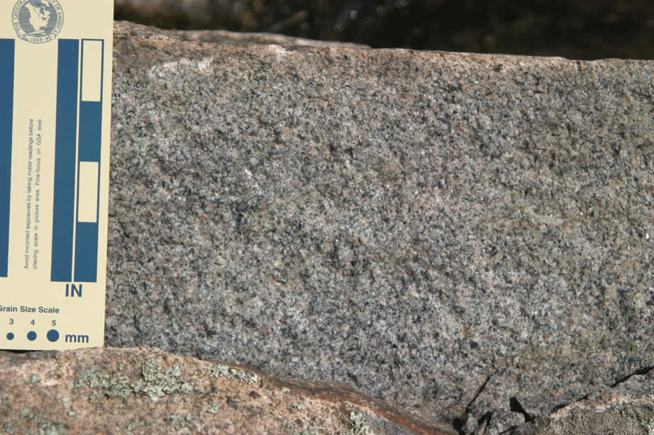 |
Sugarloaf Mountain, granite close-up. |
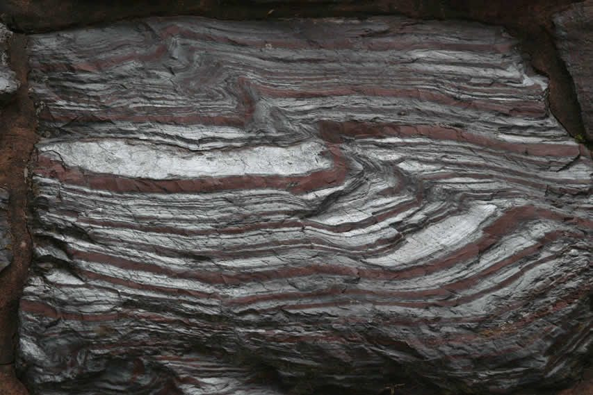 |
Negaunee - Photo of folded Jaspilite slab in monument to miners - Negaunee park. |
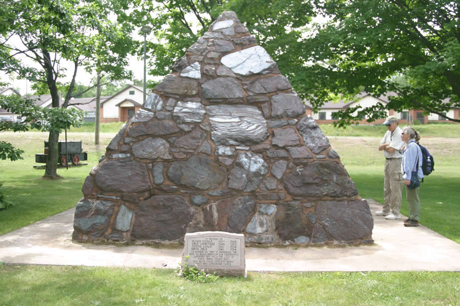 |
Negaunee - Photo of monument to miners made primarily of Jaspilite slabs in - Negaunee park (Larry, Ginny). |
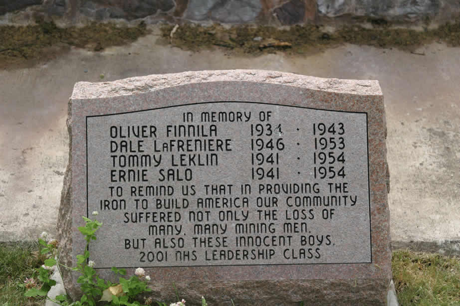 |
Memorial stone associated with Negaunee park miners monument inscription - note age of miners! |
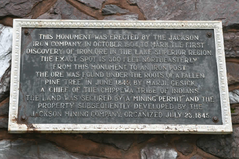 |
Negaunee - Plaque on monument to miners made primarily of Jaspilite slabs in - Negaunee park . |
 |
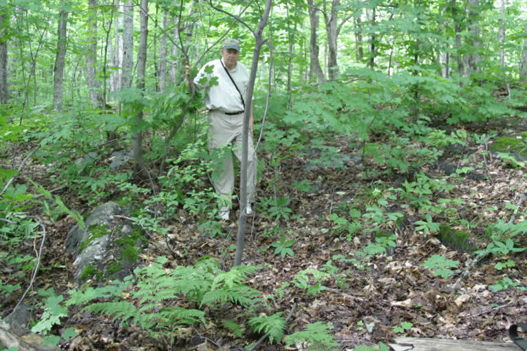
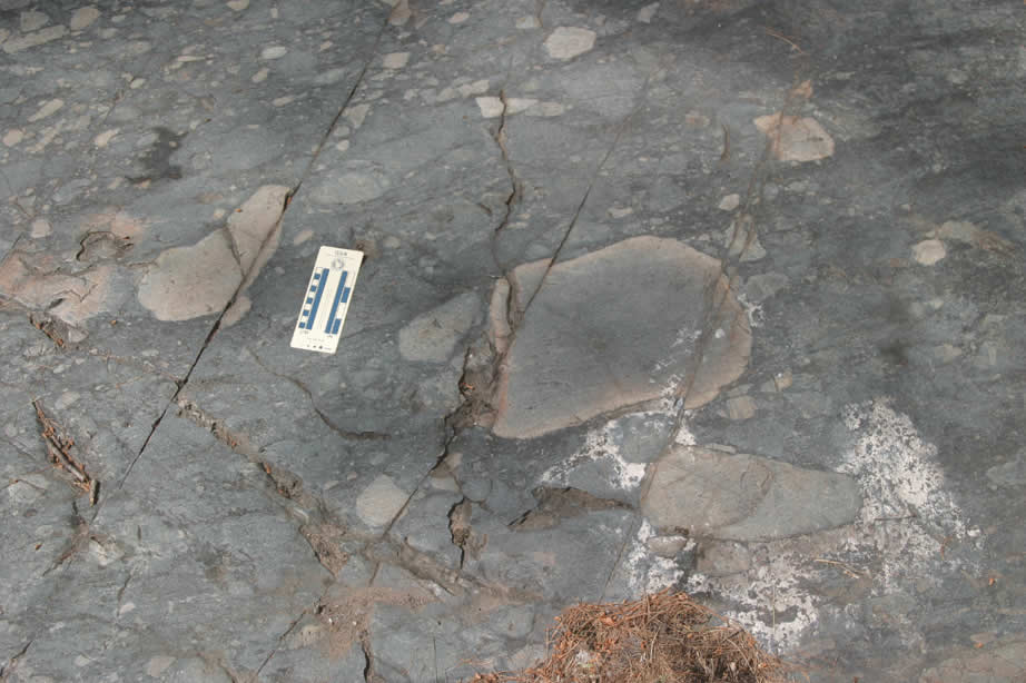
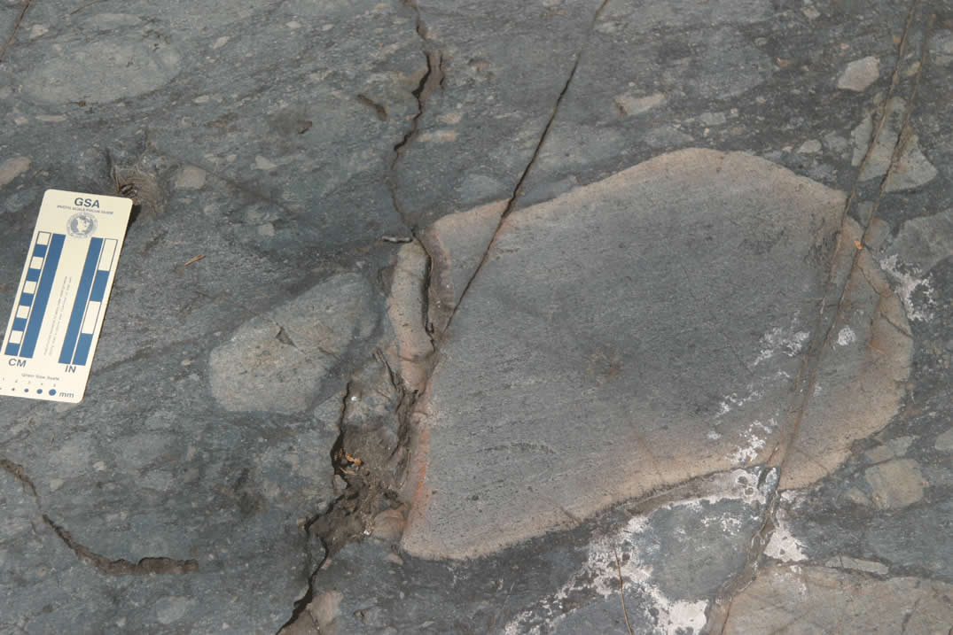
Proterozoic Enchantment lake Formation basal quartz-pebble conglomerate near contact with Archean Mona schist - in woods to NE of roadcut. Other photos showing location of contact (not exposed) with this outcrop in view. |
 |
Larry Fegel standing on contact between Proterozoic Enchantment lake Formation basal quartz-pebble conglomerate (to left) and Archean Mona schist to right - in woods to NE of roadcut. |
 |
Close up of Archean Mona schist very near contact with Proterozoic Enchantment lake Formation basal quartz-pebble conglomerate (this o/c in photo with Larry on contact) - in woods to NE of roadcut. Note glacial striations. |
 |
Upper part of Proterozoic Enchantment Lake formation at northeast end of roadcut - in contact just to left with Mesnard quartzite. Here interbedded slate and metasandstone. Dipping south. |
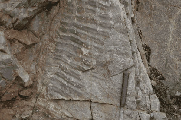 |
Ripple marks on bedding surface of Mesnard quartzite. Dipping south. |
 |
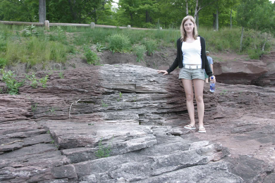
Well bedded clean Mesnard quartzite. Dipping south. Larry and Ginny for scale. |
 |
Well bedded clean Mesnard quartzite. Dipping south. Larry and Ginny for scale. |
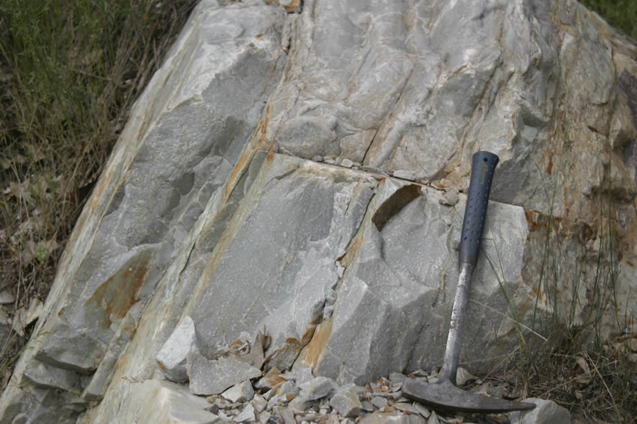 |
Close-up of Well bedded clean Mesnard quartzite. Dipping south. Hammer for scale. |
 |
Looking NE at bedding surface in Ajibik quartzite - note iron staining. |
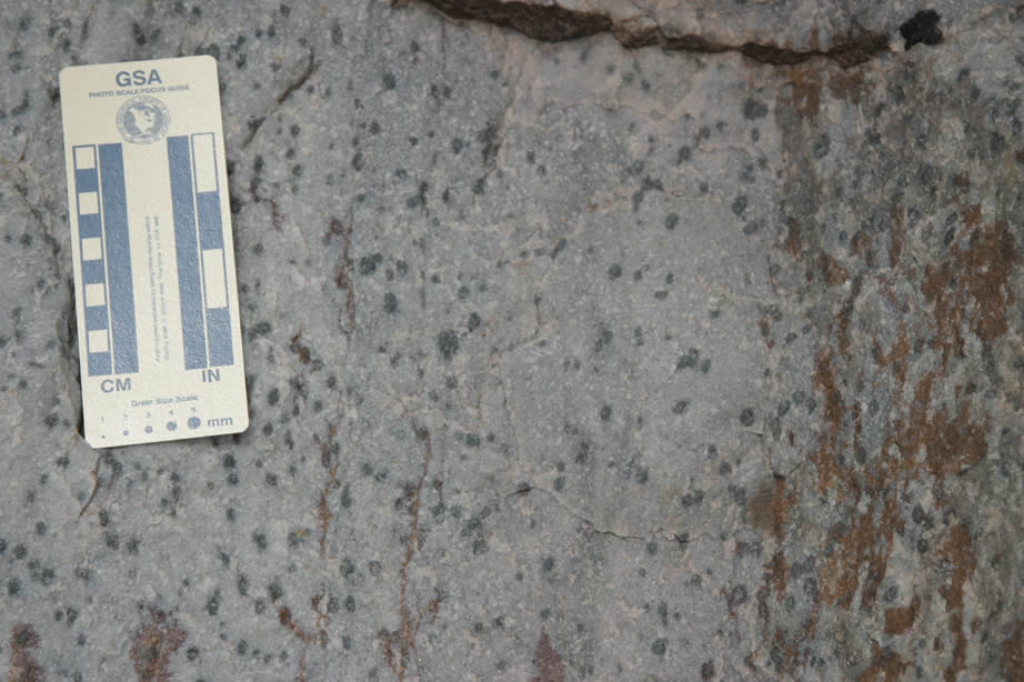 |
Locally spotty character of Ajibik quartzite. |
 |
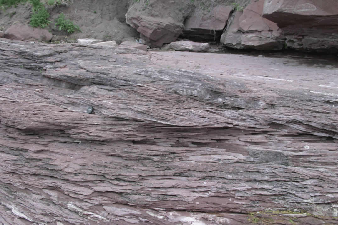
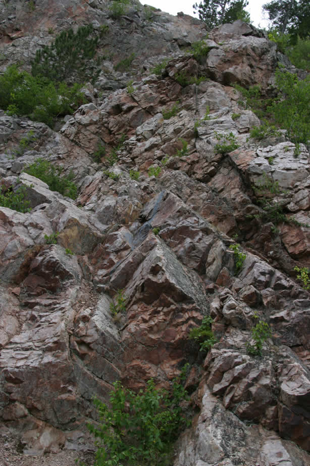
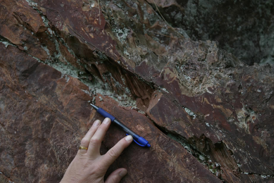
Siamo slate - lookiing ~east at OC - Bedding dips south ~ 60 degrees (note esp. thick pinkish layer) cleavage is steep to South. |
 |
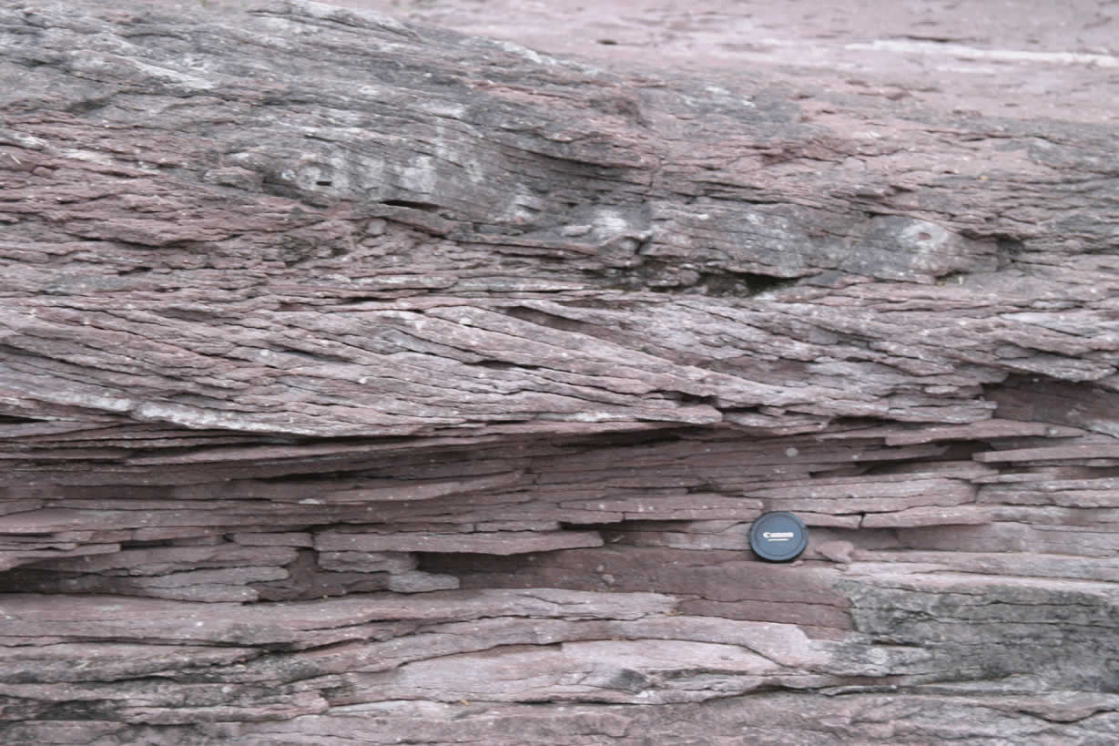
Siamo slate - close-up of bedding cleavage relationship - lookiing ~east at OC - Bedding dips south ~ 60 degrees (note esp. thick pinkish layer) cleavage is steep to South. Hand lens lanyard for scale. |
 |
Siamo slate - close-up of bedding cleavage relationship - lookiing ~east at OC - Bedding dips south ~ 60 degrees cleavage is steep to South. Hand lens for scale. |
 |
Siamo slate - lookiing ~east at OC - Bedding dips south ~ 60 degrees cleavage is steep to South. Close-up showing excellent bedding cleavage relationships - note also cleavage refraction. |
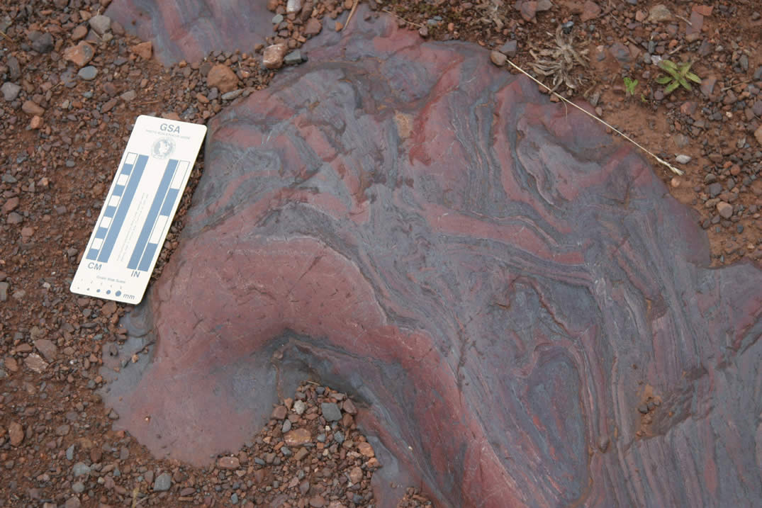 |
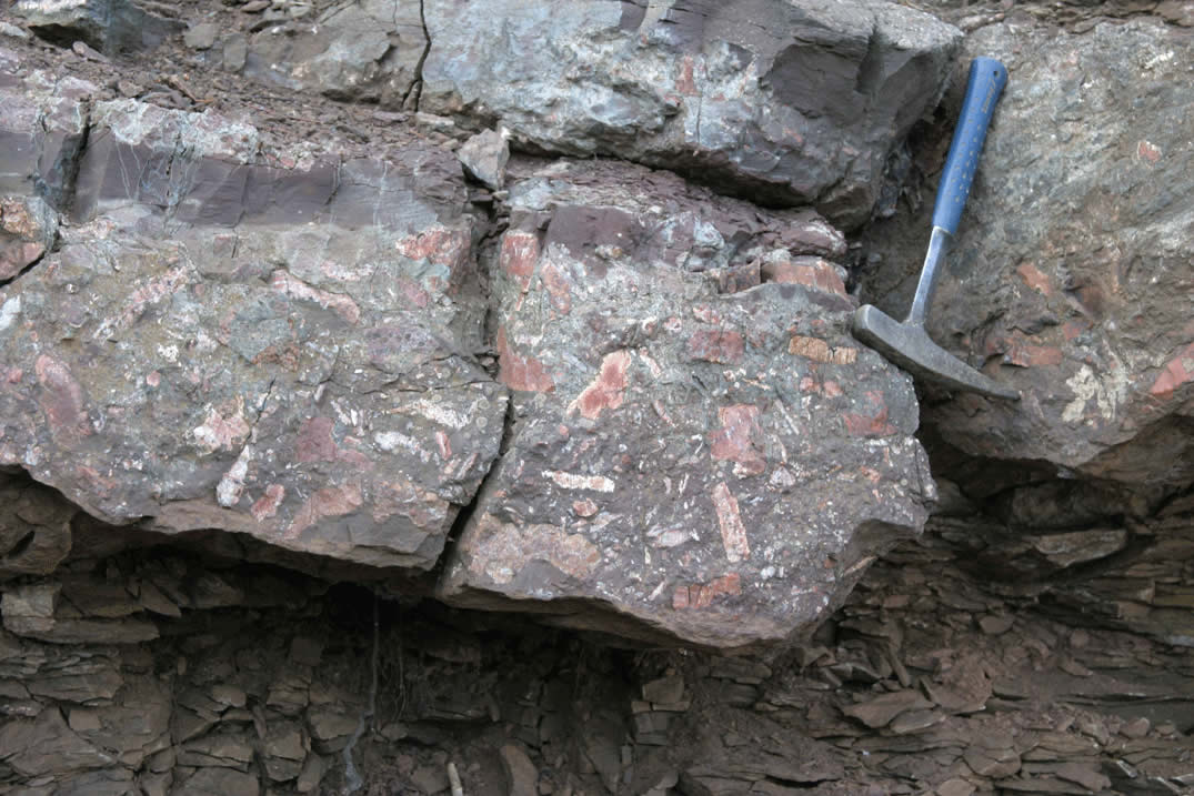
Fold interference patterns in folded Jaspilite (specular hematite and Jasper) on Jasper Knob, Ishpeming. |
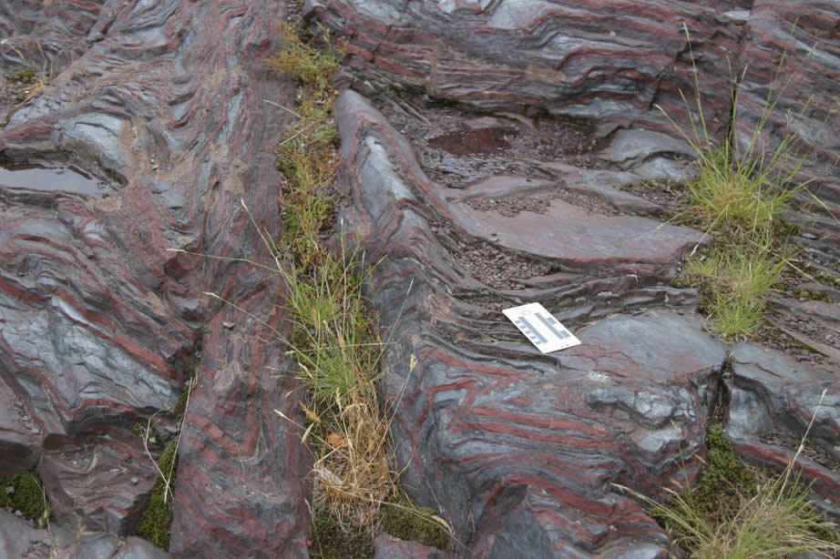 |
Fold interference patterns in folded Jaspilite (specular hematite and Jasper) on Jasper Knob, Ishpeming. |
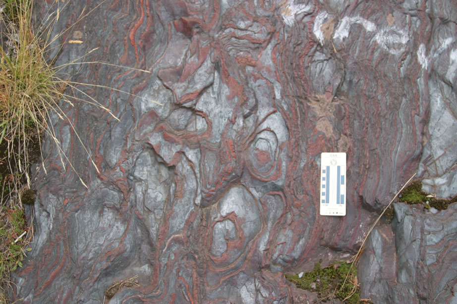 |
Fold interference patterns in folded Jaspilite (specular hematite and Jasper) on Jasper Knob, Ishpeming. |
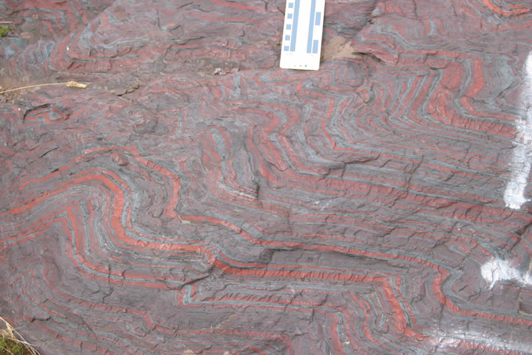 |
Fold interference patterns in folded Jaspilite (specular hematite and Jasper) on Jasper Knob, Ishpeming. |
 |
Fold interference patterns in folded Jaspilite (specular hematite and Jasper) on Jasper Knob, Ishpeming. |
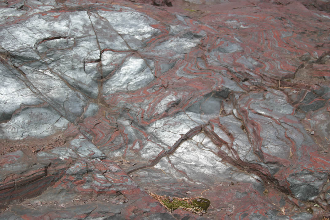 |
Fold interference patterns in folded Jaspilite (specular hematite and Jasper) on Jasper Knob, Ishpeming. |
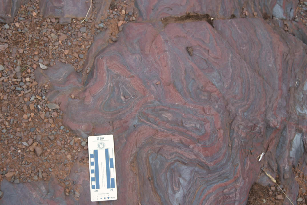 |
Fold interference patterns in folded Jaspilite (specular hematite and Jasper) on Jasper Knob, Ishpeming. |
 |
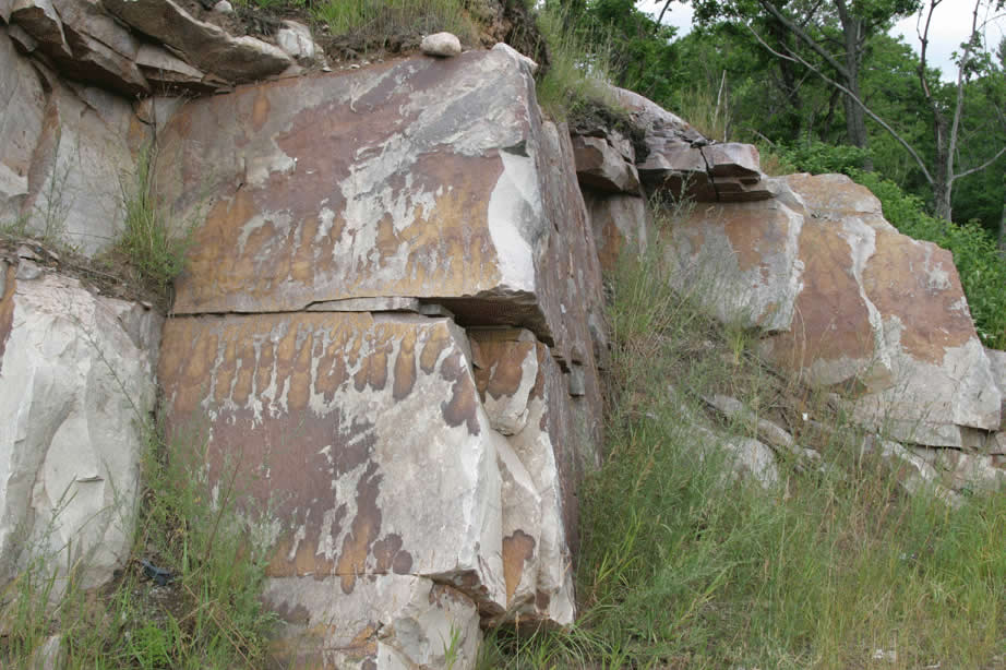
Fragmental dacite in pavement outcrop along road near south side of Deer Lake. |
 |
Close-up of volcanic clast in fragmental dacite in pavement outcrop along road near south side of Deer Lake - rock photographed in LaBerge book. |
 |
Fragmental dacite in pavement outcrop along road near south side of Deer Lake (see LaBerge). |
 |
Fragmental dacite in pavement outcrop along road near south side of Deer Lake. |
No Photos Taken. Refer to Samples and Tour info.
 |
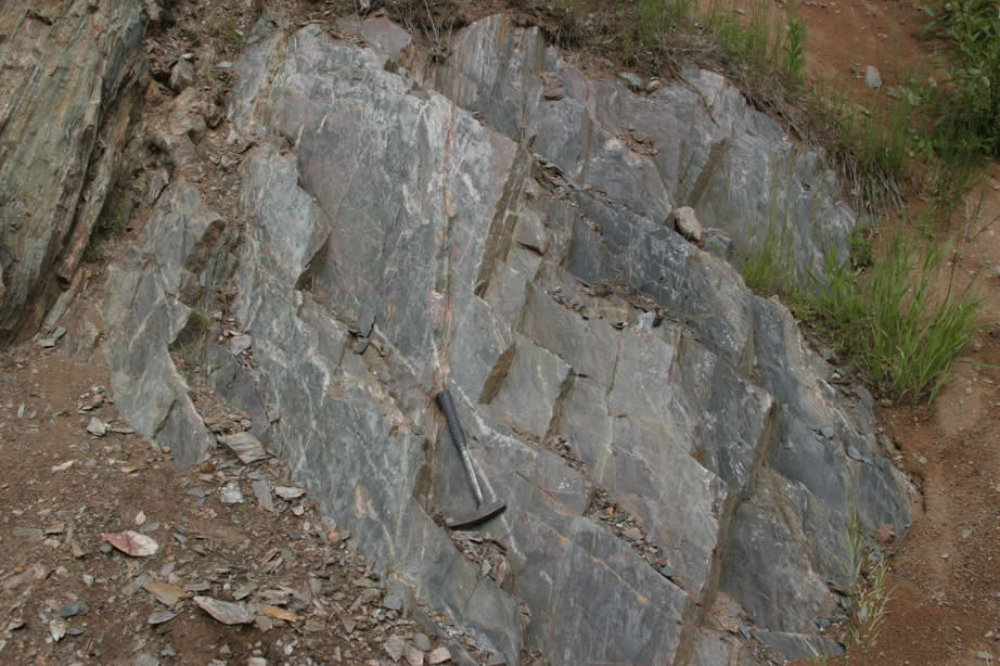
Harvey Quarry - photo of south end of quarry showing Archean Mona schist at left in fault contact with Proterozoic Mesnard quartzite. Thrust motion brings Mesnard up relative to Mona schist - remobilized fault. |
 |
Harvey Quarry - photo of north end of quarry showing Proterozoic Mesnard quartzite - dipping north. looking west. |
 |
Harvey Quarry - photo of north end of quarry showing Proterozoic Mesnard quartzite - dipping north. looking west. |
 |
Harvey Quarry - photo of north end of quarry showing Proterozoic Mesnard quartzite - dipping north. looking west. Interpreted thrust ramp crosses center of photo parallel to bedding. |
 |
Harvey Quarry - photo of southmost end of quarry showing Archean Mona schist. looking west. |
 |
Harvey Quarry - photo of south end of quarry showing Archean Mona schist at left in fault contact with Proterozoic Mesnard quartzite. Thrust motion brings Mesnard up relative to Mona schist - remobilized fault. |
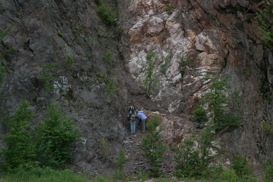 |
Harvey Quarry - photo of south end of quarry showing Archean Mona schist at left in fault contact with Proterozoic Mesnard quartzite. Thrust motion brings Mesnard up relative to Mona schist - remobilized fault. Ginny and Jill standing on fault. |
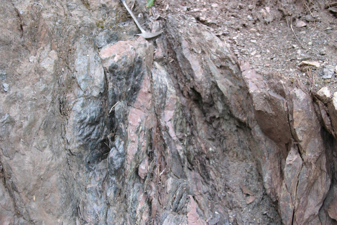 |
Harvey Quarry - photo of fault zone between Archean Mona schist at left and Proterozoic Mesnard quartzite. Thrust motion brings Mesnard up relative to Mona schist - remobilized fault. S/C fabrics indicate thrust motion - right side up. |
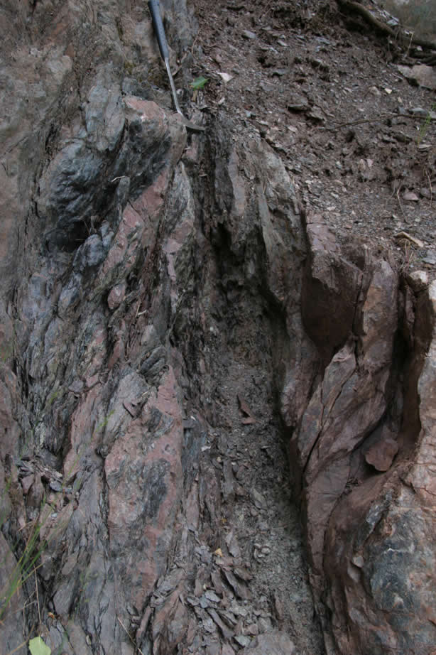 |
Harvey Quarry - photo of fault zone between Archean Mona schist at left and Proterozoic Mesnard quartzite. Thrust motion brings Mesnard up relative to Mona schist - remobilized fault. S/C fabrics indicate thrust motion - right side up . |
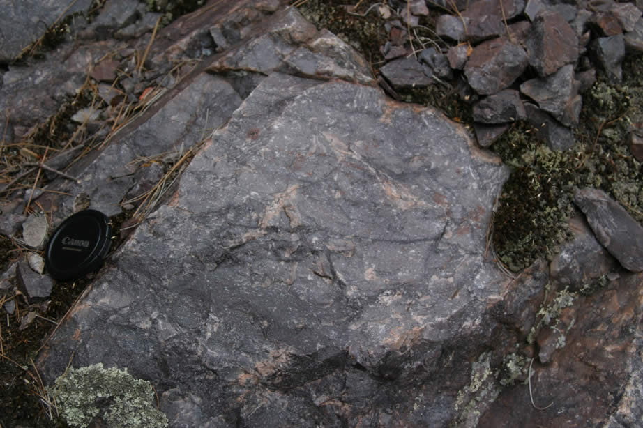 |
Harvey Quarry - close-up of mesnard quartzite. |
 |
Harvey Quarry - close-up of Mona Schist. |
 |
Harvey Quarry - north central part of o/c - photo of bedded Mesnard quartzite - dipping north (right) - looking west. |
 |
Harvey Quarry - close-up of Mesnard quartzite showing north dipping bedding (parallel to pen) and thin bed above pen that shows steeper cleavage. |
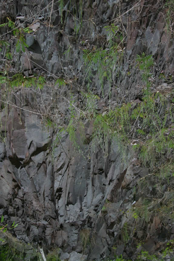 |
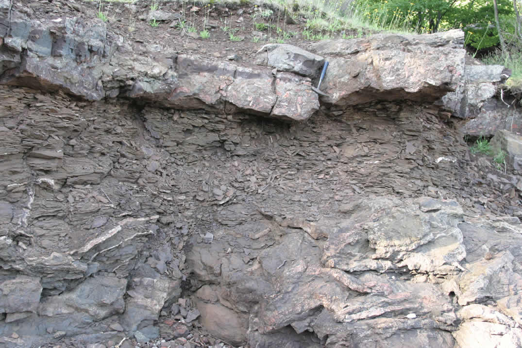
Harvey Quarry - photo of northernmost end of quarry showing slaty layers in Mesnard quartzite - note near vertical cleavage. |
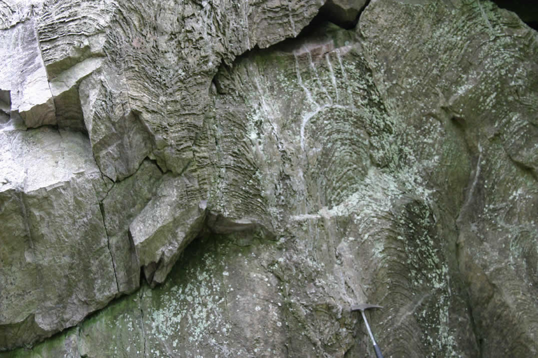 |
Harvey Quarry - north of quarry behind south end of road cut - exposures of stromatolites in kona dolomite. |
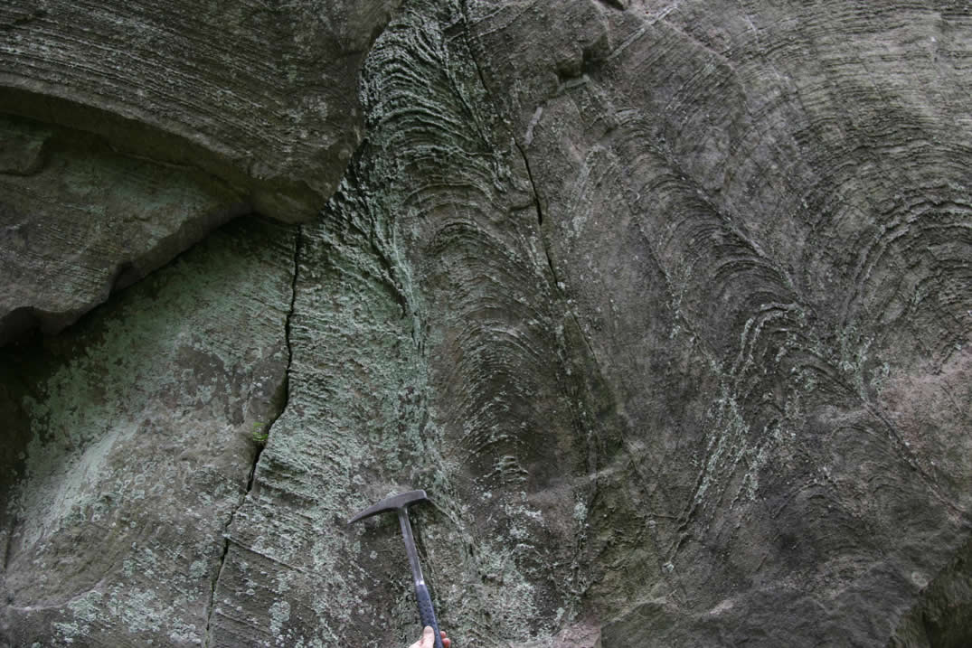 |
Harvey Quarry - north of quarry behind south end of road cut - exposures of stromatolites in kona dolomite. |
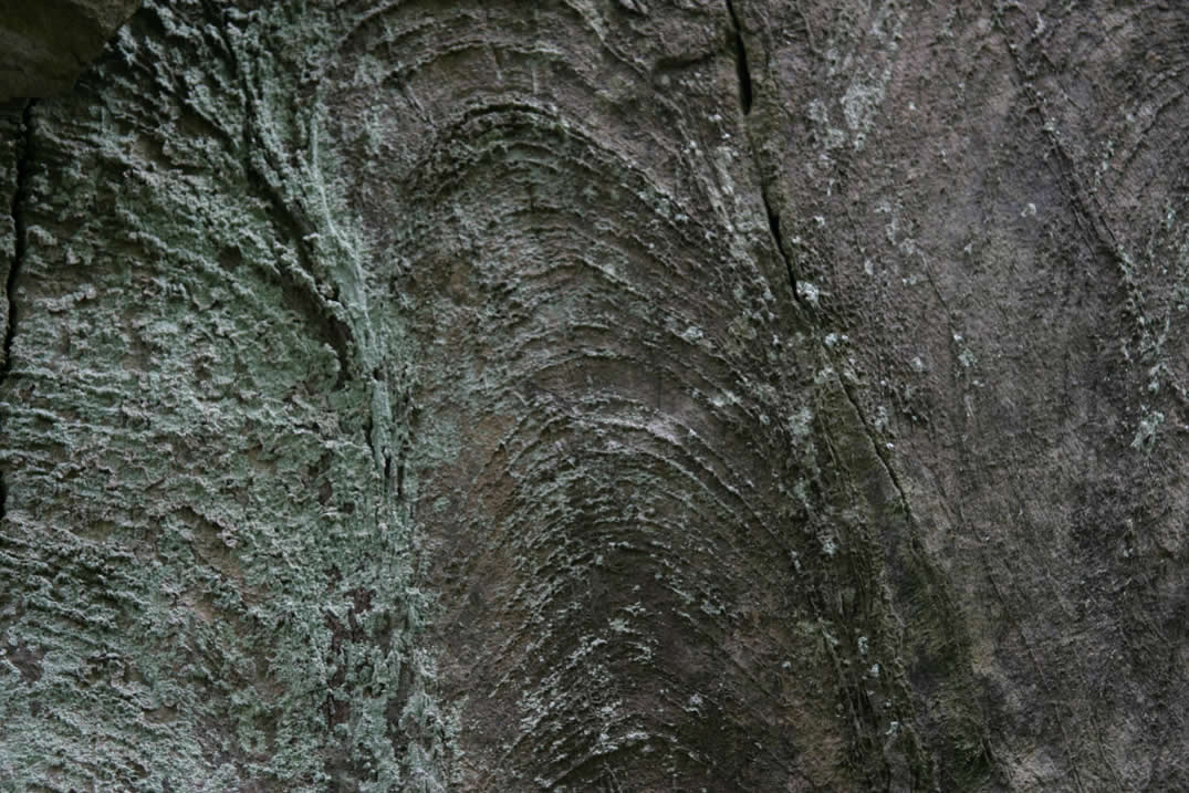 |
Harvey Quarry - north of quarry behind south end of road cut - exposures of stromatolites in kona dolomite. |
 |
Harvey Quarry - north of quarry behind south end of road cut - exposures of stromatolites in kona dolomite. |
 |
Harvey Quarry - north of quarry behind south end of road cut - exposures of stromatolites in kona dolomite. |
 |
Harvey Quarry - north of quarry behind south end of road cut - exposures of stromatolites in kona dolomite - steep cleavage parallel to pen and nearly perpendicular to bedding. |
 |
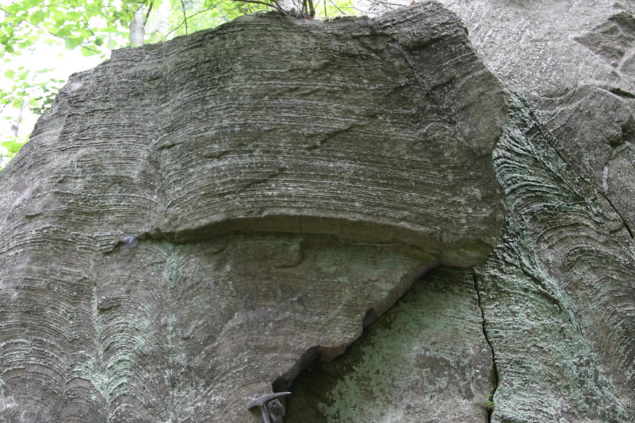
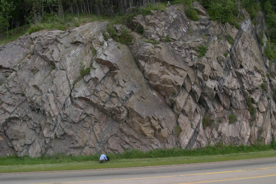
North of Harvey Quarry - south end of road cut - exposures of well bedded Kona Dolomite - shows nice cleavage bedding relationship (south dipping bedding - steeper cleavage). |
 |
North of Harvey Quarry - south end of road cut - exposures of well bedded Kona Dolomite - shows nice cleavage bedding relationship (south dipping bedding - steeper cleavage - parallel to pen). |
 |
North of Harvey Quarry - south end of road cut - exposures of well bedded Kona Dolomite - shows nice cleavage bedding relationship (south dipping bedding - steeper cleavage) - here rocks within Kona are more quartz rich. |
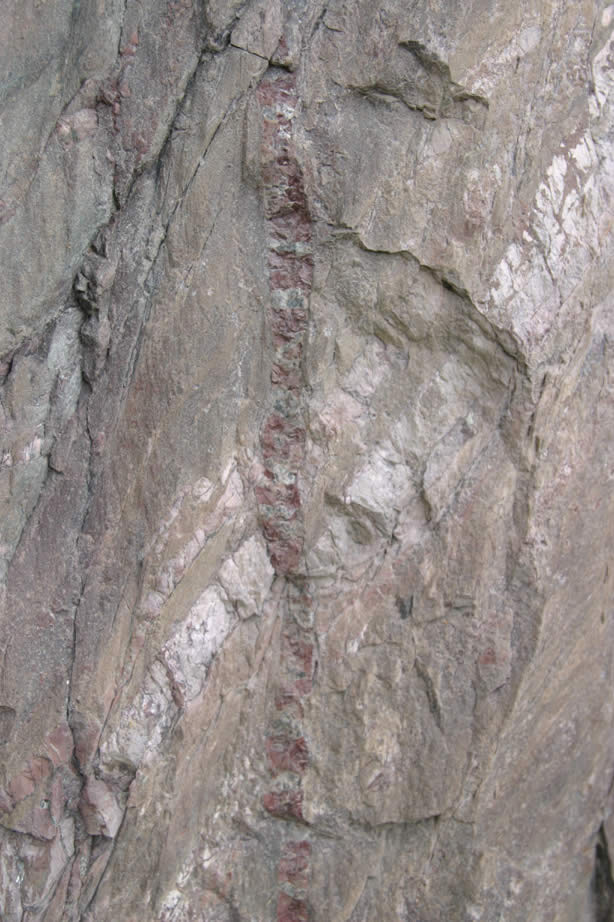 |
North of Harvey Quarry - south end of road cut - bedded rocks withing Kona Dolomite - cut by red-colored vein. |
 |
North of Harvey Quarry - south end of road cut - exposures of well bedded Kona Dolomite - shows nice cleavage bedding relationship (south dipping bedding - steeper cleavage). |
 |
North of Harvey Quarry - road cut - exposures of predominantly quartzite - well bedded within Kona Dolomite unit - Ginny and Jill for scale. |
 |
North of Harvey Quarry - road cut - exposures of predominantly quartzite - well bedded within Kona Dolomite unit - Ginny for scale. |
 |
North of Harvey Quarry - road cut - exposures of predominantly quartzite - well bedded within Kona Dolomite unit - Ginny for scale. |
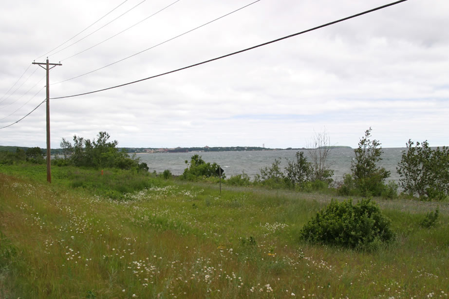 |
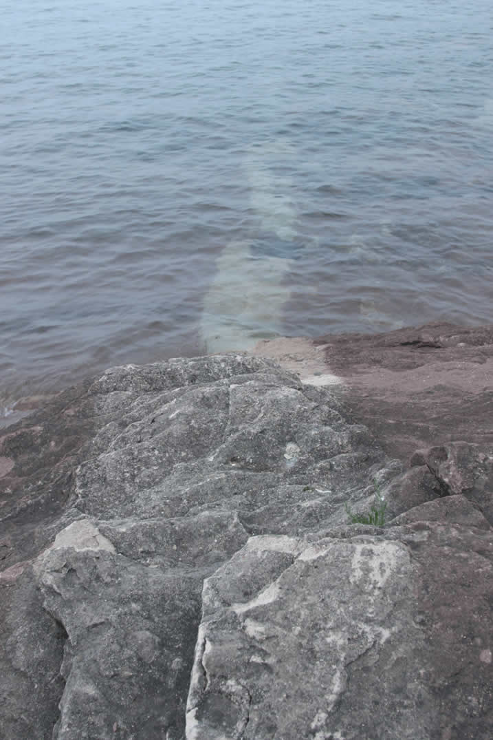
View north toward Marquette at Lake Superior from Harvey Quarry Roadcut. |
 |
North of Harvey Quarry - road cut - exposures of predominantly quartzite - well bedded within Kona Dolomite unit. |