Maps of Pictured Rocks |
Browse the maps by type, look carefully at the air photos and read the location info. |
| Tours | Photos | Videos | References | Maps | PR Home | Home |
Maps: |
|---|
Other Maps: |
| Location Key: |
|---|
PR1 -- Munising Falls |
Location Info:
City: Munising
County: Alger
GPS:
Directions to the Visitor Center from Grand Rapids: Take US131 N for about 133 miles. Turn right onto MI66/MI72 and continue for 24.3 miles. Turn left on onto I-75 BL / MI-93. Turn right onto I-75 BL / Hartwick Pines Rd. / MI-93. Merge onto I-75 North via the ramp on the left. Continue for 85.3 miles. Merge onto US-2 W via exit 344B toward Manistique / Escanaba. Continue on this for 65.5 miles. Turn right on MI-77 (17.3 mi). Left onto MI-28 (35.1 mi). Located at the junction of state highway M-28 and county road H-58 in Munising (400 E. Munising Ave.) Along the trip, you will need to pay a toll to cross the Mackinac Bridge. Maps of the different trails can be found here.
The visitor center's phone number is 1-(906)-387-3700. Open year round, 9 a.m. to 4:30 p.m., with extended hours in the summer season. Closed Sundays, holidays and October to mid May.
Noted features: Cliffs of sandstone, containing the Jacobsville Sandstone, the Munising Formation and the Au Train formation. Borders along Lake Superior. Part of the Hiawatha National Forest. The Pictured Rocks National Lakeshore covers 73,236 acres, along a 42 mile stretch along Lake Superior. Backpacking and camping are permitted here.
Approx elevation: ???
| Tours | Photos | Videos | References | Maps | PR Home | Home |
Map Index
Click to enlarge any map. Maximize for best view.
 top top |
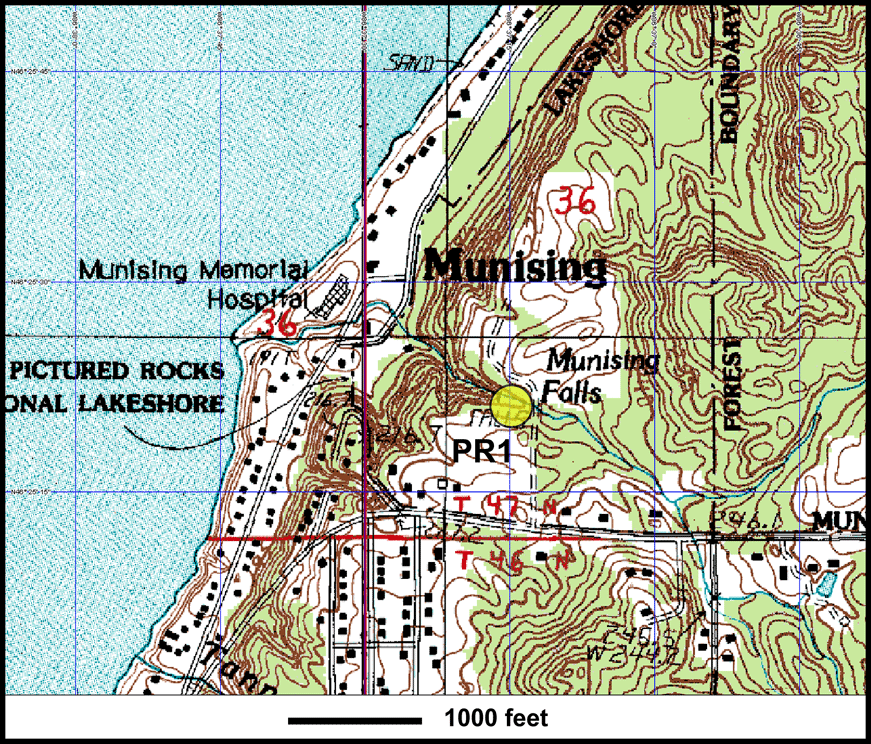
Close-up topographic map of stop PR1, Munising Falls. |
 top top |
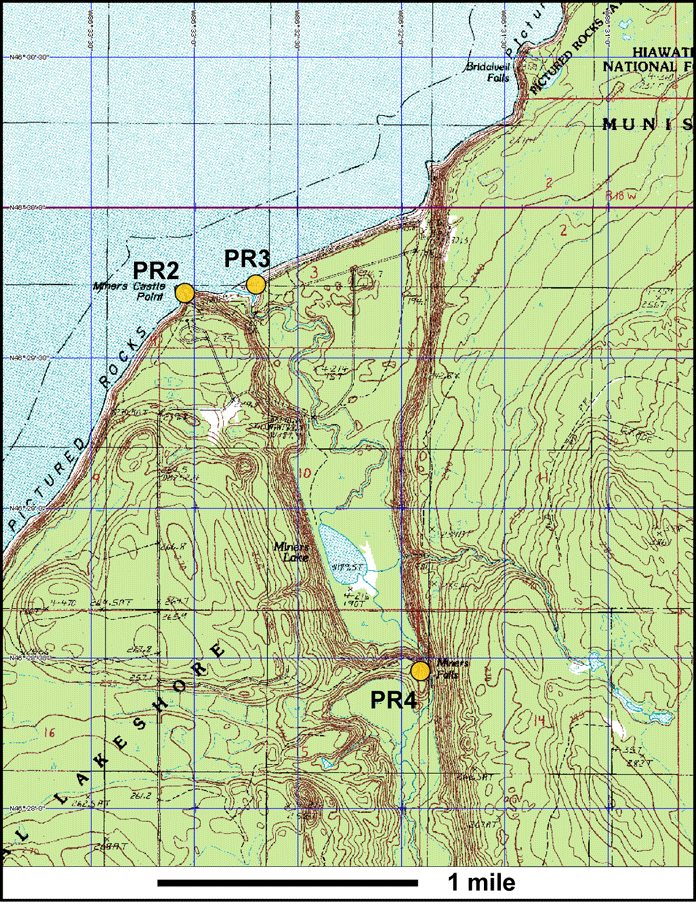
Close-up view of stops PR2, PR3 and PR4. |
 top top |
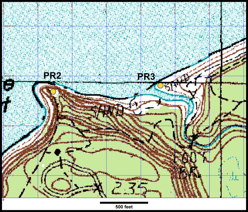
Closer look at PR2, Miner's Castle and PR3, Miner's Beach. Topo map. |
 top top |
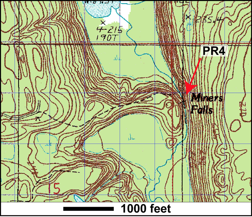
Close-up topographic map of PR4, Miner's Falls. |
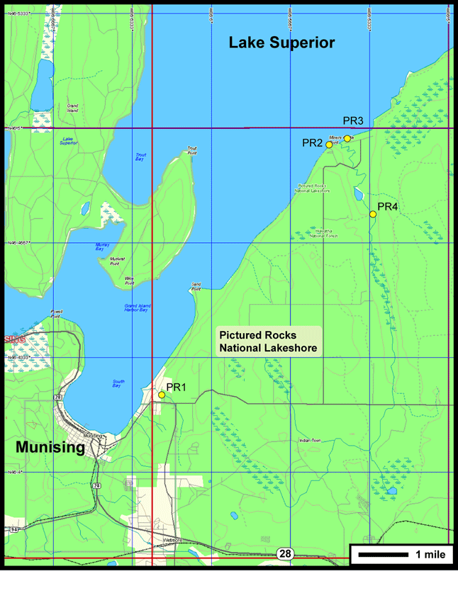
Complete overlook of Pictured Rocks area topographic map including view of all stops. |
|---|