This exposure lies along the southeastern margin of the old Grand Ledge Clay Products Company Quarry, which is mostly filled with water. The dominant rock exposed along the southern quarry wall is fine, grey-weathering sandstone that grades downward to medium- to dark-grey shale. A thin coal bed overlies the sandstone along the eastern quarry wall. The shale, sandstone, and overlying coal are interpreted to be part of the Pennsylvanian Saginaw Formation. Much of the shale, which was the quarry target, is now underwater. When the water level was lower, fossil Lingula (a brachiopod) were commonly found in the shale at this locality.
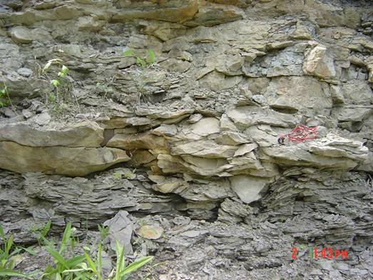
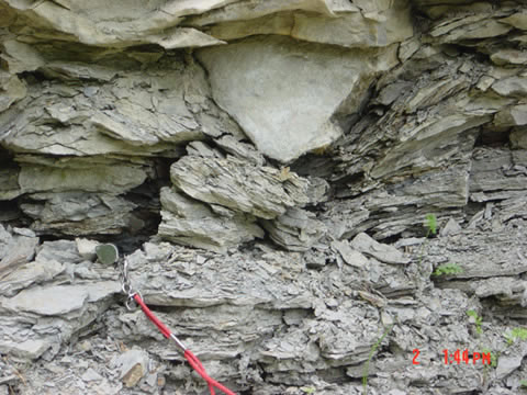
This photo, looking south, shows the gradation from the lower part of the quarry wall dominated by finely layered, fissile grey shale to the upper part of the quarry wall dominated by more massive, lighter colored fine-grained sandstone. Note the relatively sharp and irregular sandstone/shale contact just below the midline of the photo. In the detail below, the irregularity of this sand/shale contact is evident where the upper sandy layer appears to push down into the shale below. This feature was likely to have formed while the sediments were still unconsolidated (not lithified). How might this feature form?
The photo to the left shows a detail of the fine sandstone that makes up the upper part of this outcrop. It is littered with dark fossil root impressions of the genus Stigmaria (Velbel and Brandt, 1989). Note the dark elongate features that lie nearly vertical and at a high angle to bedding.
Click on the yellow dotted areas to see close up views of the fossil impressions.
![]()
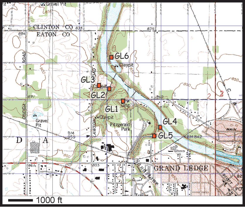
You are at GL2.
Station 2 |
||||
| Tours | Photos | Videos | References | Maps | GL Home | Home |