This station is located within Lincoln Brick Park (an Eaton County park) along the upper northern wall of the old Face Brick quarry, north and across the river from Fitzgerald Park.
The following quote regarding the clay company that mined this site is from http://www.gdledgehistsoc.org/history-clay.html
" The brick company was founded in 1914 as the Baker Clay company. The factory bought 50 acres of land along the river from the Walker farm at the corner of West Main and Tallman Road on the north side. The plant featured a “continuous kiln” design. Unlike the bee-hive design, the continuous kiln allowed heat from one kiln be used to preheat the next adjoining kiln. The plant was founded to produce glazed silo tile. The plant soon switched to brick production. The Grand Ledge Face Brick Co. was owned for a time by the Briggs Company in Lansing , later the plant was sold to the Lincoln Brick company. The plant was closed in 1947. In 1975 the land, now grown to 90 acres, was sold to Eaton County . The site is now Lincoln Brick Park."
The rocks observed at this station are sandstones from the Grand River Formation, similar to those observed at Stations GL4 and GL5.
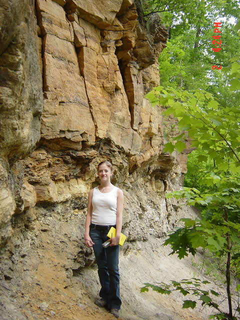
This photo of the old quarry wall shows the character of the sandstone here. The lower part of the outcrop is fairly disrupted and includes fragments of coal layers. Just above Jill's head there is a sharp change to layers that are more continuous and relatively thick and massive. The sandstone here has a distinct rusty weathering color.
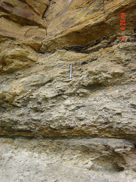
This close-up shows the disrupted character of the lower part of the outcrop. The disrupted part has a brecciated look and includes a dismembered coal fragment just below the transition to more massive, thickly bedded sandstone. Cross bedding is visible near the base of the outcrop here.
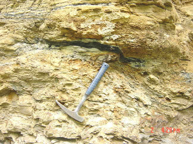
(Below) Detail of disrupted part of sandstone unit with coal bed fragement.
You are at the end of the Grand Ledge GeoTour.
You are at GL6.
Station 6 |
| Tours | Photos | Videos | References | Maps | GL Home | Home |