When you study a sequence of sedimentary rocks it is useful to construct a stratigraphic section that shows the characteristics of the different rock units defined during field observation, the thickness of the units and their relationships to each other. This involves describing the rock units, measuring their thickness and displaying these observations on a scaled and labeled vertical column.
We will demonstrate some of the field approaches for collecting information to build a simple stratigraphic section for the Grand Ledge area based on our observations.
Measuring thickness of stratigraphic units
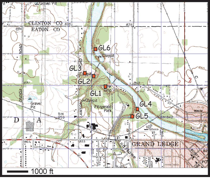
The video below demonstrates the process of measuring and generally describing a stratigraphic section in a single outcrop exposure at Grand Ledge station GL1.
(Stratigraphic Section Overview video from Station 1.)
In addition to the general look at the section demonstrated in the video, we record detailed information for each rock unit such as rock types, grain size, color, fossils, sedimentary structures, thickness of layers, etc. See the observations provided for the individual Grand Ledge units.
Also, click on the video below to see how to measure individual units.
(see 3 Stratigraphic Units video from Station 1.)
A stratigraphic section may be compiled from single outcrops where the units of interest are well exposed or they may be a composite of observations from several outcrops. For example, we also measured and described the upper sandstone unit (Grand River Formation) at the excellent exposures along the river at Grand Ledge station GL3.
(Measuring and Describing a Stratigraphic Section from Station 4.)
The Stratigraphic Nomenclature of Michigan includes a stratigraphic column that shows the relationships between all of the sedimentary rock units in Michigan , younger than the Precambrian. In addition the stratigraphic section uses graphical symbols to show the rock types that characterize each unit and the variations within each unit. For each unit, the information shown integrates information from across the state, both from surface and subsurface (e.g. drill holes) information.
Use the information provided throughout the Grand Ledge tour to construct a stratigraphic section of the Grand Ledge area. Note that the two videos above provide the thickness information that you need. Draw your section to scale using a ruler – try to use as much of the paper as possible (A scale of 4' per inch should work well for letter size paper) and use different symbols to represent the different rock types. For each unit your section should show the maximum thickness plus any variations observed. Label the formation names, give your section a title and be sure to include a legend.
Measuring a stratigraphic section |
| Tours | Photos | Videos | References | Maps | GL Home | Home |