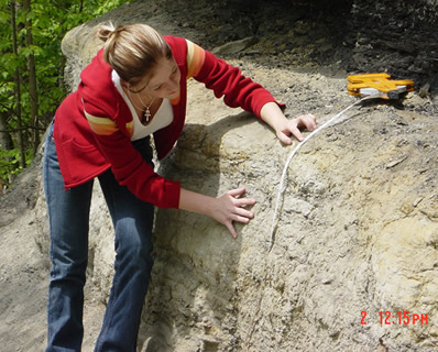
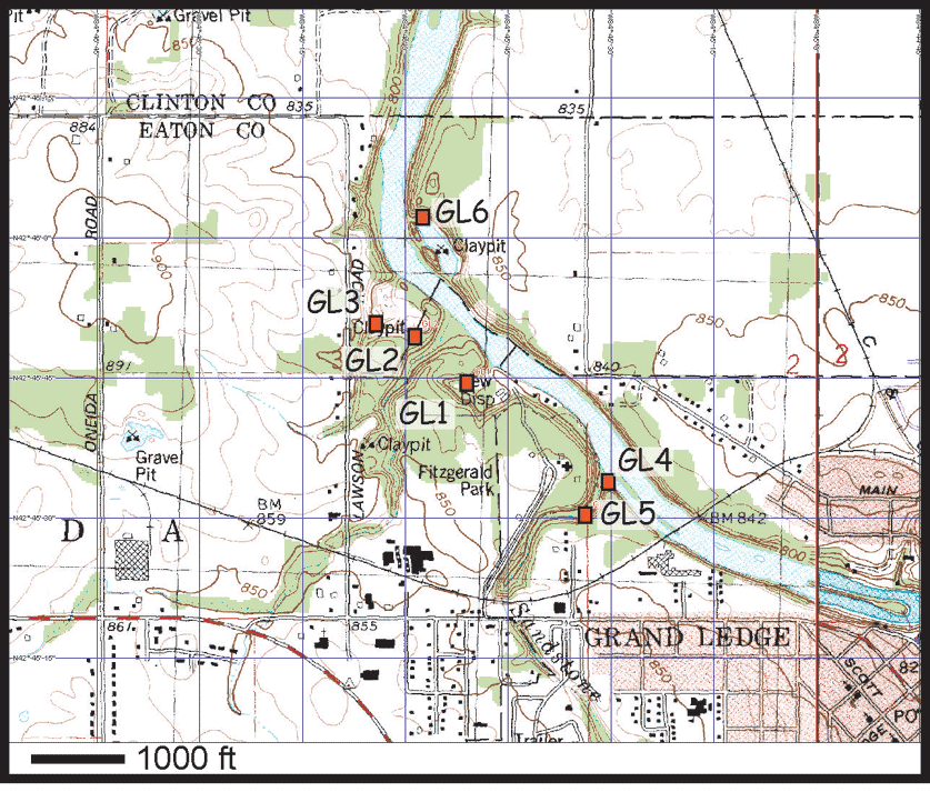
Jill measures the thickness of the lower sandstone at Station 1.
(see 3 Stratigraphic Units video - Part 1 ).
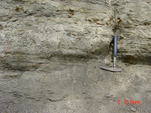
This is a minimum thickness because the base of the unit at this locality is covered and below the level of exposed rock. Note that the fine layering gives the rock a more massive appearance at a distance.
This photo shows some of the variations in the lower sandstone at station GL1. In the lower part of the photo, the rock is covered by loose talus weathered from the outcrop. Note the finely laminated character giving way upward to thicker beds (several centimeters thick) with some brown weathering knots that appear to be iron concretions. Overall this is a fine, silty sandstone and generally grey-weathering.
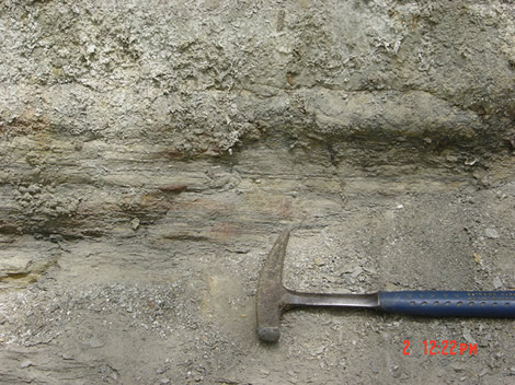
Photo above shows close-up of finely laminated lower part of lower sandstone. Note the millimeter scale of layering here.
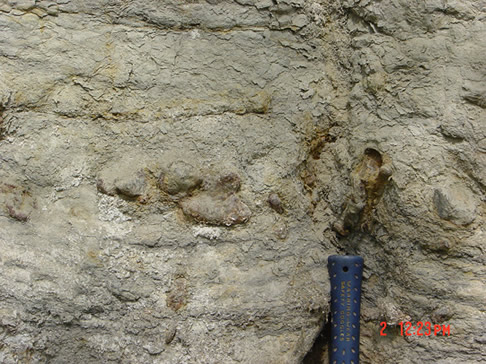
This photo shows a close-up of the small iron concretions in the lower sandstone.
Some web references on iron concretions:
From the Australian Museum Online:Concretions, Thunder Eggs and Geodes
http://www.amonline.net.au/geoscience/earth/concretions.htm
From the Kentucky Geological Survey
http://www.uky.edu/KGS/coal/webrokmn/pages/vein.html#concretions
CONCRETIONS AND NODULES IN NORTH DAKOTA
http://www.state.nd.us/ndgs/ndnotes/concretions/concretions_h.htm
Iron Concretions on Mars:
http://marsrovers.jpl.nasa.gov/newsroom/pressreleases/20040318a.html
Comparing iron concretions found in Utah with those on the Moon
http://www.aapg.org/explorer/2005/05may/mars_blueberries.cfm
| Tours | Photos | Videos | References | Maps | GL Home | Home |